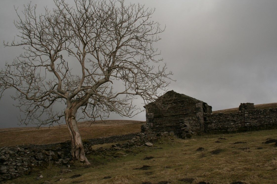
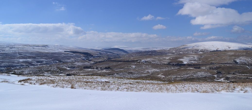
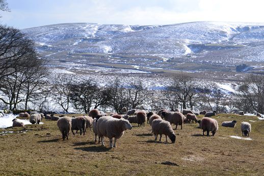
local Walks
BOOK NOW

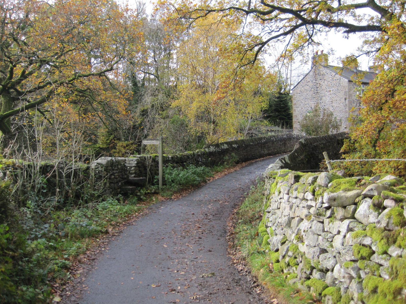
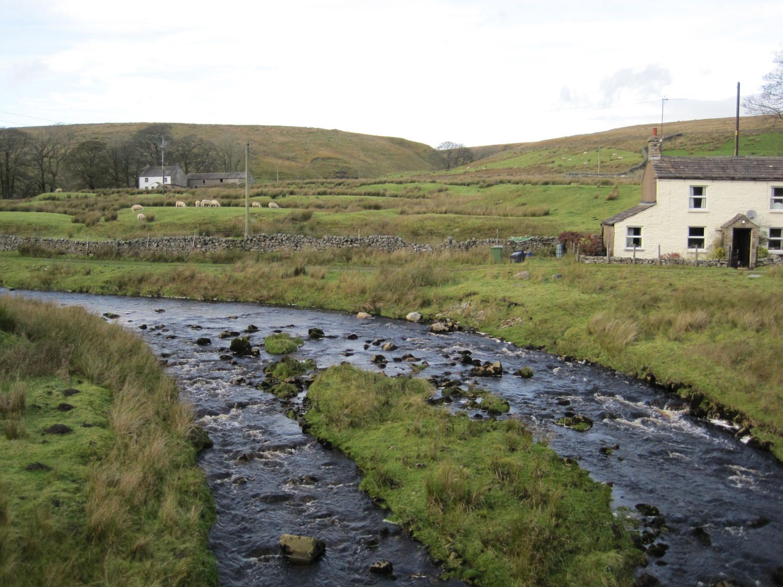
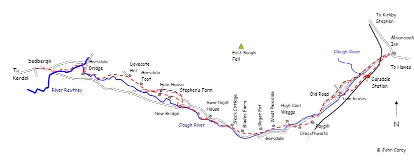
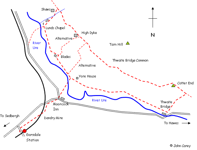
Walks To & From Goats & Oats at Garsdale
Walks To & From Goats & Oats at Garsdale
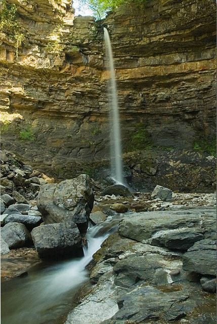
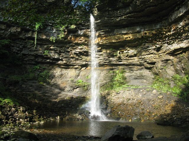
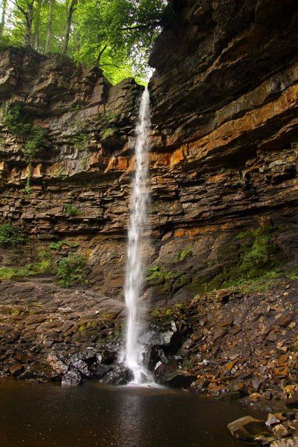
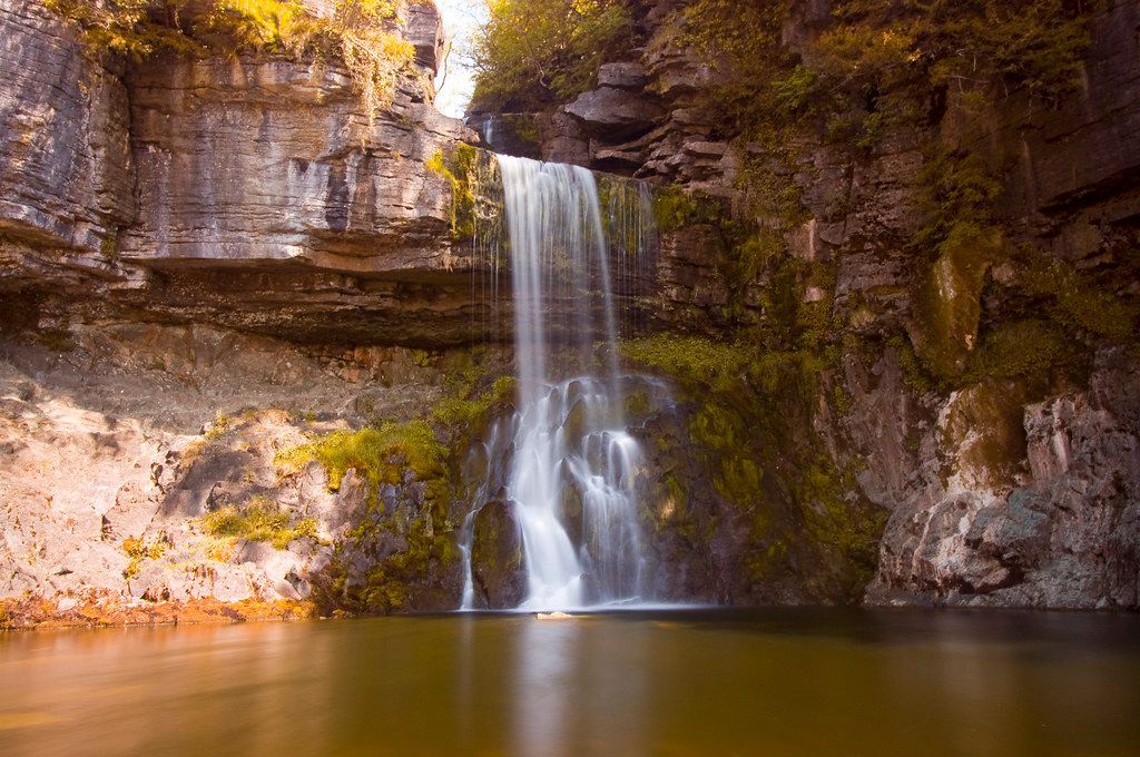
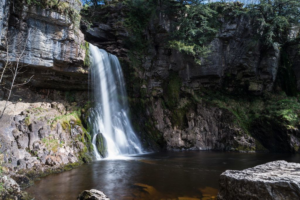
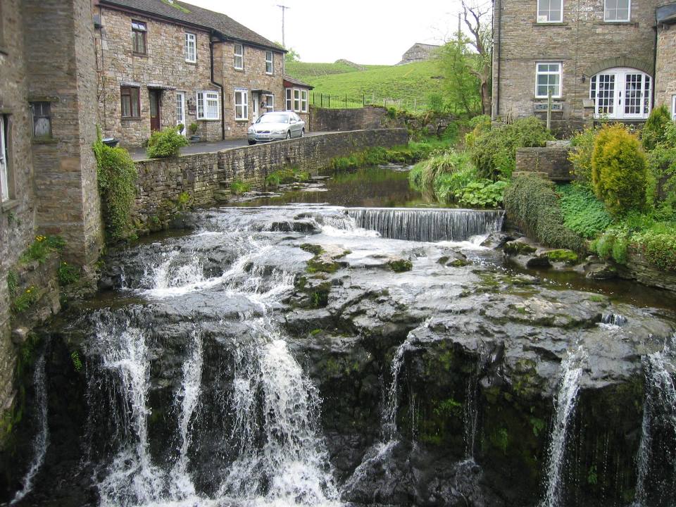
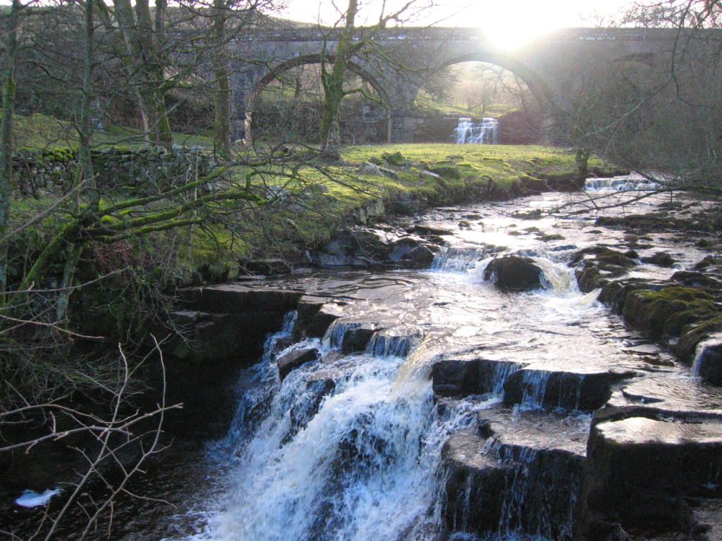
Hardraw Force
-
Hardraw Force
- 7 miles
- 3.5 hours
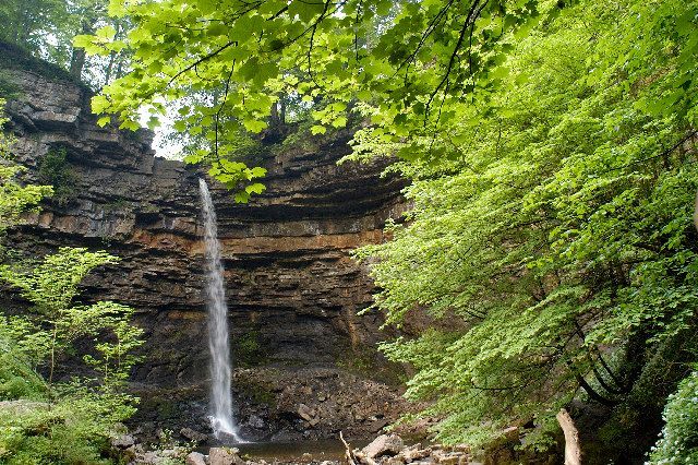
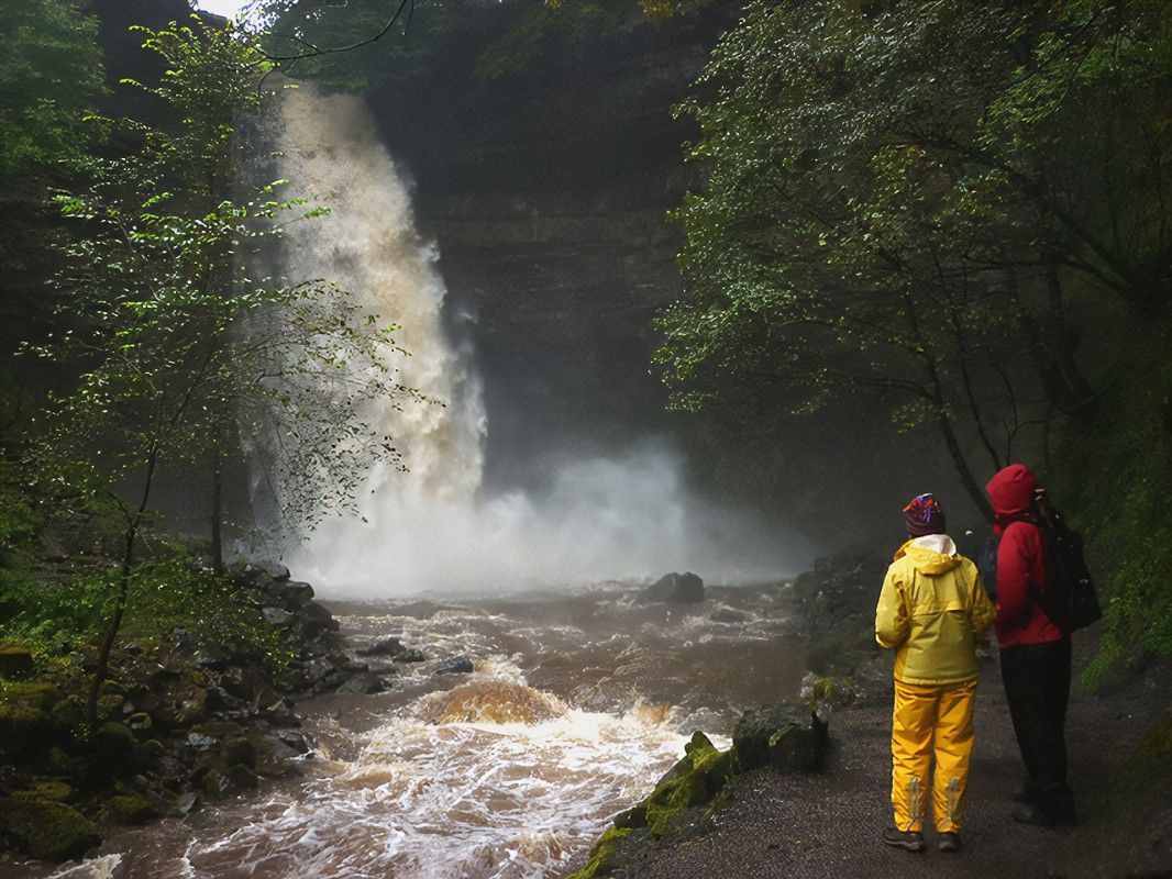
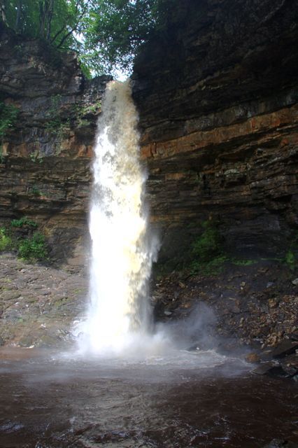
Hardraw Force is said to be England’s highest unbroken overground waterfall at 30m high.
To view this beautiful natural force, you must go through a pub - though we don't mind that!.
Hadraw Force was actually featured in the film Robin Hood: Prince of Thieves for the scene where Maid Marion catches Robin bathing under a waterfall!
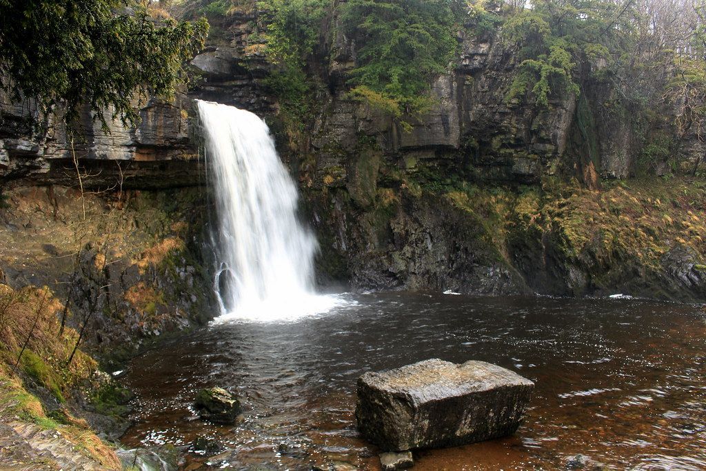
Ingleton Waterfall Trail
-
Ingleton Waterfall Trail
- 4.2 miles
- 2.5 hours
The perfect walk if you want to capture some beautiful photos - you could even take a packed lunch with you for a picturesque afternoon.
Ingleton Waterfall Trail is a lovely route that features multiple waterfalls including Pecca Falls, with the impressive and rather tropical looking Thornton Force.
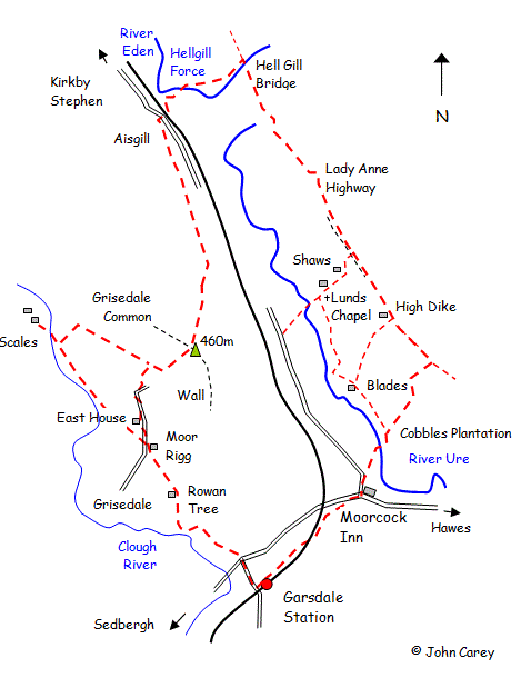
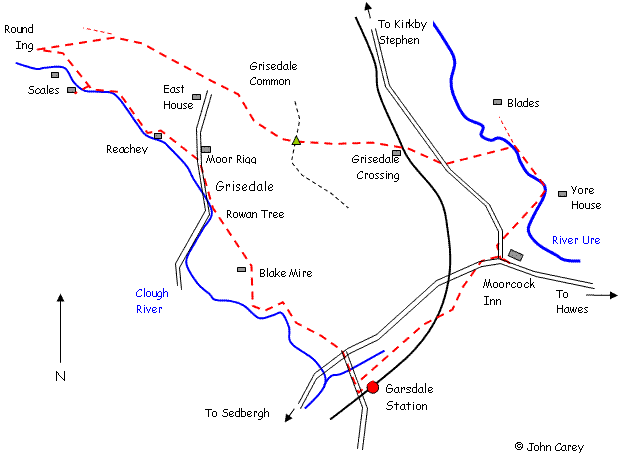
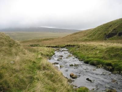
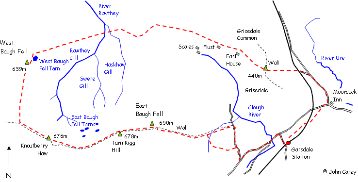
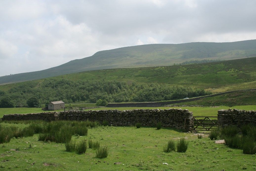
Grisedale and Hellgill Circular
-
Grisedale and Hellgill Circular
A family walk over Grisedale Common [461m] to Hellgill Force *
A moderately easy circular walk from Garsdale Station or Garsdale House suitable for families taking in Grisedale and Hellgill Force waterfall
- 8 miles
- 4 hours
- Maximum elevation 460m
There is the option to add the short detour to the Quaker settlement at Scales making the walk 10 miles. By Car or train - equally this could be started from Garsdale House.
From Garsdale Station walk down the road to the T junction with the main Hawes - Sedbergh road. Immediately on the other side of the T junction look for a stile in the wall.
Note: If starting from Garsdale House, proceed along the main road towards Sedbergh. Ignore the first footpath on the right and take 2nd path on right opposite the T junction to Garsdale station and follow as depicted in the map.
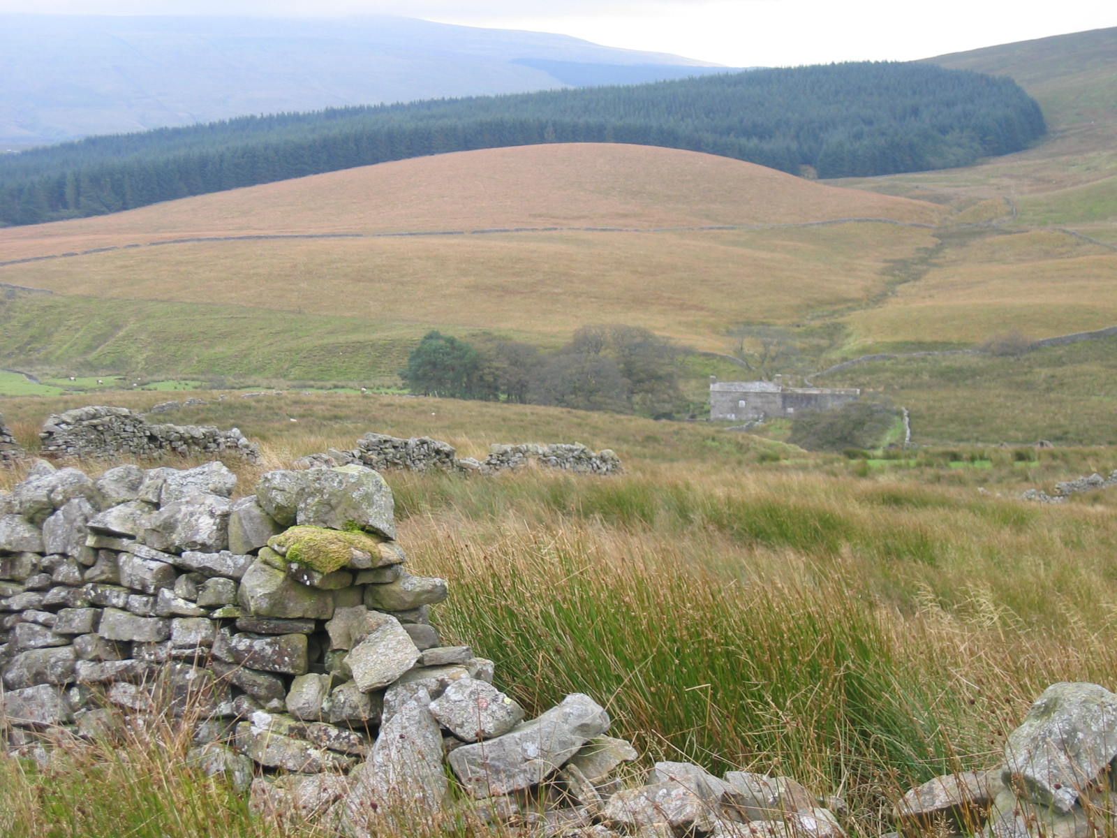
Passing through the stile proceed uphill across the rough pasture and another stile. The ground starts to level out a bit. Proceed for a short while passing through a gate to the right hand side of Blake Mire Farm. Proceed in the same direction across more rough pasture and collapsed walls to Rowantree, now a track, crossing a small stream and thence uphill across pasture through a gate to Moor Rigg at which point the minor road serving Grisedale is reached.
There is an option to detour to Scales at this point adding 2 miles. If so cross the minor road and follow the footpath crossing tow stiles to meet the Clough River. Follow the righthand river bank all the way to Scales eventually crossing the small bridge. Retrace steps back to the bridge and follow the track up the hill bearing right at the top to pass through a ford. Now continue along the track until just above East House. At a waymark post turn left to rejoin the path across Grisedale Common
Bear right and follow the road uphill to East House, The road passes through a gate and becomes a track at this point zig-zagging up the hill with a wall on the right. When the track levels out slightly bear left at a waymark post and proceed uphill to the crest of the open pasture [can be difficult to follow] or keep to the track as it works its way around to the crest of Grisedale common and a wall in effect in a large loop. If the latter easier route is followed, upon meeting the wall at the top, bear left and proceed with the wall on the right. Ignore the first gateway and stile and follow uphill for 500m. Both routes, either direct or indirect, should eventually reach a metal bridleway gate on the crest of the ridge. With luck you will pass a few fell ponies enroute.
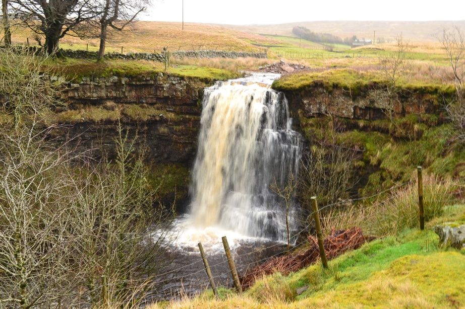
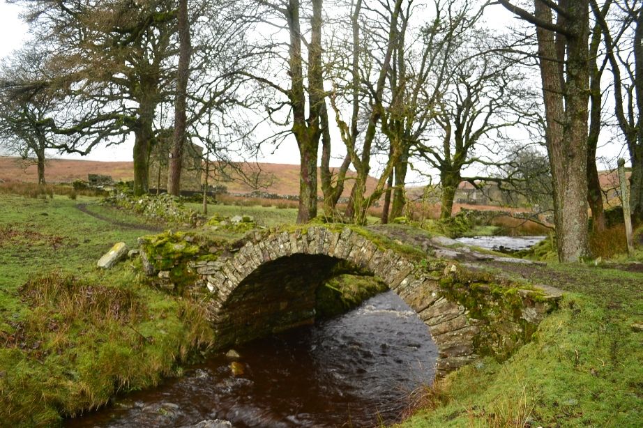
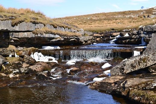
Passing through the metal gate now proceed down hill bearing left and contouring around the hillside. Sometimes this path is difficult to spot but the objective is to eventually proceed in a northerly direction dropping downwards to meet a wall and barn. At this point the path will be paralleling the railway line all the way to Aisgill. Pass to the right hand side of the barn and continue along an easy path to Aisgill through a gate and to the road. Bear left along the road for 100m and then turn right [just before the cottages] along a track passing over the railway line. The track bears left and at then right. At this change in direction make a slight deviation to Hellgill Force, a spectacular waterfall with a good vantage point and possible lunch stop above. This feature is easily missed as it is located below the track. Take the right hand track and proceed up the hill across a bridge through a farm to Hell Gill Bridge turning right to cross a very narrow and deep ravine. This track is the old coach road known as Lady Anne Highway.
Follow the gently undulating 'highway' in a southerly direction taking the left hand fork [at a vehicle prohibition sign] eventually with a wall to the right. After 1 mile the ruin of High Hall is reached and a ford. Another 2/3 mile further along the highway reaching a gate across the track. There are two main options for the return either using the Pennine Bridleway or via Lunds.
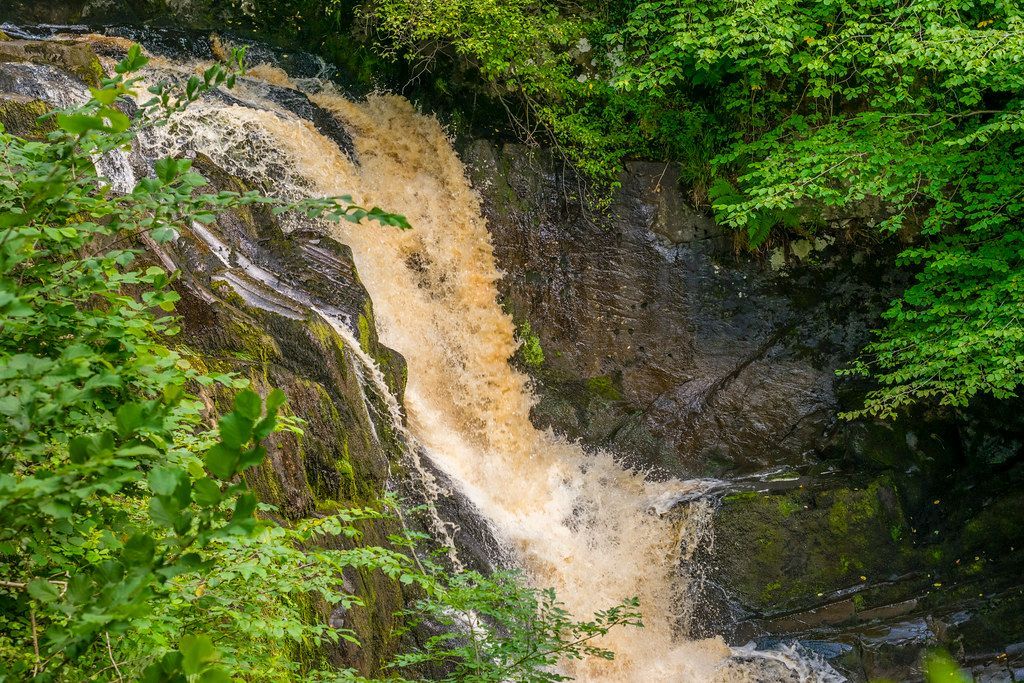
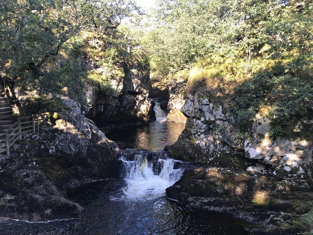
The easiest involves passing through the gate and carrying on along the highway. The track dips into a small ravine and has been subject to landslip in the past. About 1/4 mile after the ravine look for a new gate in the wall together with Pennine Bridle Path sign post. Pass through the gate with a lime kiln on the left. The bridleway is waymarked with wooden posts down to the side of Cobbles Plantation and emerging at Ure Force waterfalls. Cross the bridge and follow the bridleway to Garsdale House.
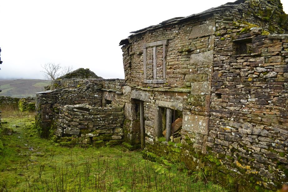
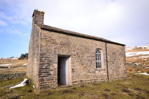
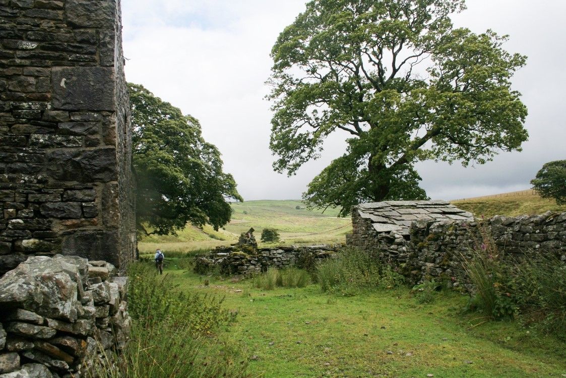
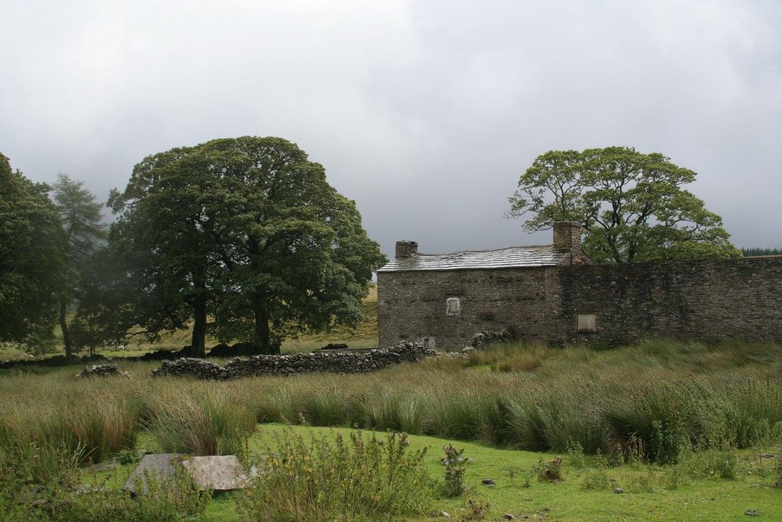
The second option takes in Shaws Waterfall and Lunds Church: Passing through the stile immediately before the aforementioned gate on Lady Anne Highway proceed directly and then diagonally downhill to a gate at the rear of Shaws and the by steps (take care as can be very slippy!) down to a wooden footbridge in front of the waterfall. Shaws, now a private house was formerly the Garsdale Youth Hostel until the 1970s. Continue downhill across another footbridge and passing through a farmyard to the little hamlet of Lunds with it's now disused and privately owned church. The church (open to visitors) and graveyard are worth investigation.
Note there are various ways back from Lunds - an alternative more straightforward way is to cross the river by the footbridge at the perimeter of the churchyard and follow plantation access track up to the main road, turn left and thence back to Garsdale House. The downside is 1/2 mile of road walking! Alternatively:-
Bear left at the church and passing through a stile over Cowshaw Hill and two more stiles. This now becomes difficult to follow and some map reading is required! With the pasture boundary on the right look for a stile at the slight change in direction. Turn right to pass over the stile and then immediately left passing over very rough pasture towards Blades, a small hamlet of cottages. The path has been redirected pass to the left (rear) of the farmhouse through two stiles and crossing a small stream joins the farm access track. At a right hand bend in the track go straight on following the left hand bank of the River Ure. Eventually the path will meet Ure Force waterfalls and an old bridge with it's modern replacement alongside. Cross the bridge and follow the Pennine Bridleway to Garsdale House. Please note that this latter option whilst having the attraction of a visit to Shaws waterfall and Lunds Church can be unpleasantly muddy between Lunds and Blades Farm.
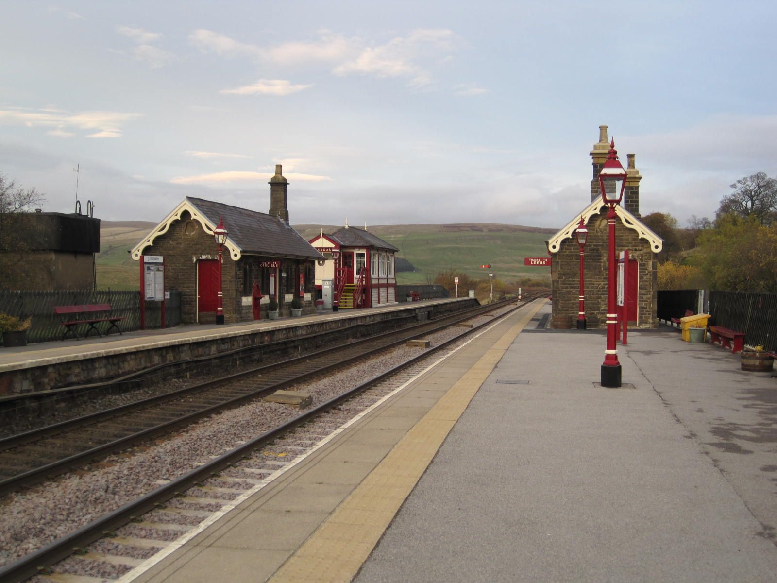
For the return walk to Garsdale Station, on leaving Garsdale House turn right and proceed along the main road towards Sedbergh for a very short while, then turning left through a gate to follow the Pennine Bridleway which proceeds directly to the rear of the station passing under Dandry Mire Viaduct enroute. The station is slightly under a mile from the pub and 30 -35 minutes should be allowed for this uphill walk! Remember that southbound trains run from the farthest platform and it is necessary to pass under the road bridge to gain access.
Important note:- Whilst the author has taken every care in assembling the information on this site, no responsibility can be accepted for any error or omission herein. If in any doubt walkers should always consult the relevant OS map. All timings are approximate and for a person of average fitness and ability.


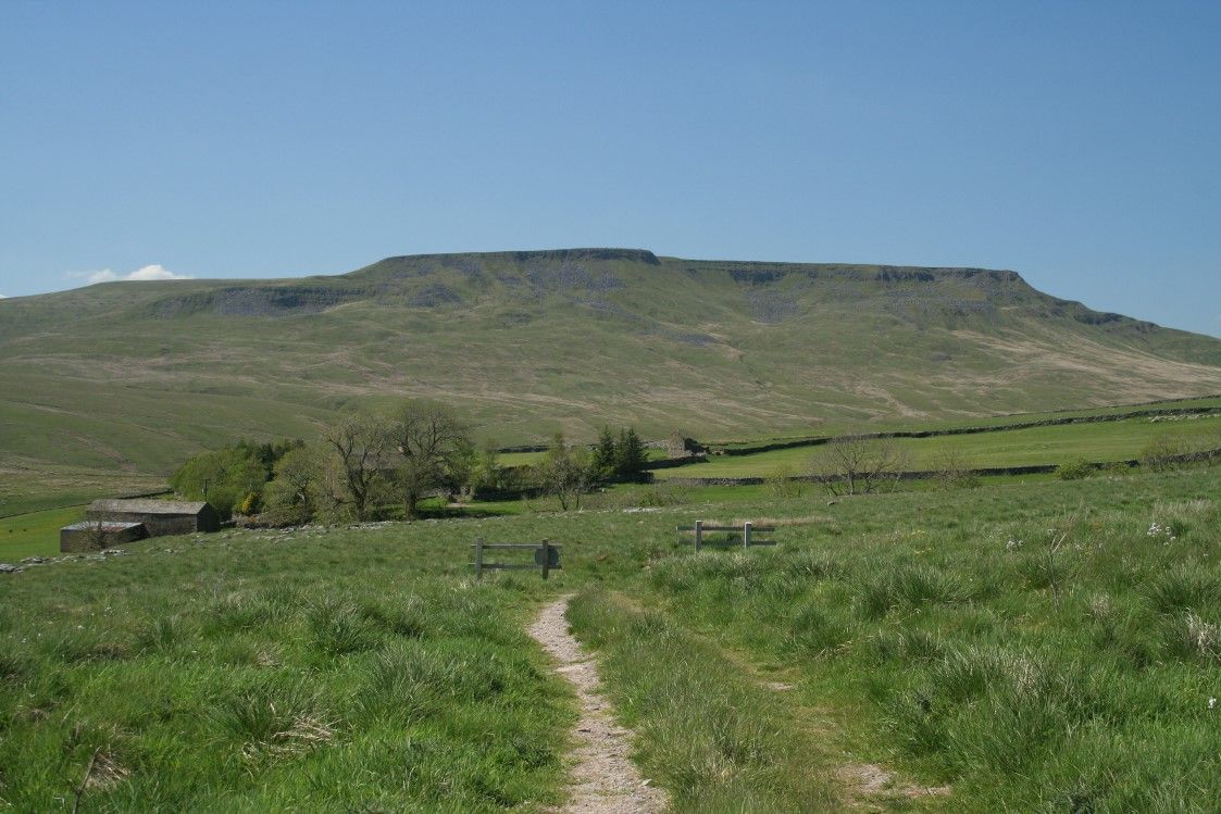
Wild Boar Fell
-
Wild Boar Fell
An excellent days' outing starting at Kirkby Stephen Station and finishing at Garsdale House or Garsdale Station
- 12 miles
- Approximately 6 hours
This linear walk takes in Little Fell [559m], Wild Boar Fell [708m] and Swarth Fell [681m] whilst viewing the impressive panorama of the Mallerstang Valley plus glimpses of the Howgills and Three Peaks ending at Garsdale House. For this reason the walk is best done north to south as Kirkby Stephen Station is lacking in local amenities and a good 1.6 miles from the town centre. This could be done by car or train - if arriving by car park at either Kirkby Stephen or Garsdale stations and travel one stop on the train.
From Kirkby Stephen Station turn immediately left and walk along the main road. After 1/4 mile turn left towards Sedbergh and after 100m turn left again along a minor road towards Low House. Just before Moor End Farm turn right through a gate onto open pasture. There is a track which becomes a very faint path but generally progress in a southerly direction for a good mile or so with the objective of Wild Boar Fell in view.
Upon reaching Tommy Road, in fact a minor road, turn left and proceed along the tarmac for 1/4 mile before branching out right over Wharton Fell with the summit of Little Fell in sight. The grassy path quickly meets a wall on the left hand side passing a barn.
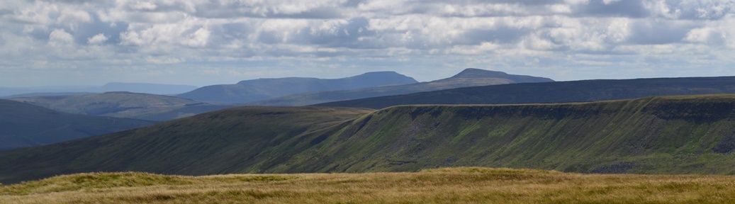
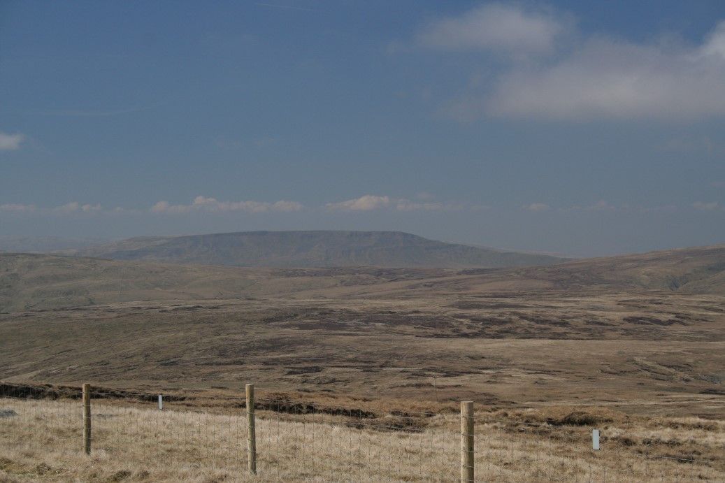
Pass the summit cairn of Little Fell [559m] and maintain the same direction now with Wild Boar Fell in sight. The path drops down slightly to meet a wall and then increases in steepness as the summit is reached. This is in fact a plateau with dramatic drops and views across Mallerstang on one side. The Wild Boar [708m] summit cairn proper demands a slight deviation to the right where there are good views over to the Howgills. However, arguably the views into the Mallerstang Valley are more dramatic.
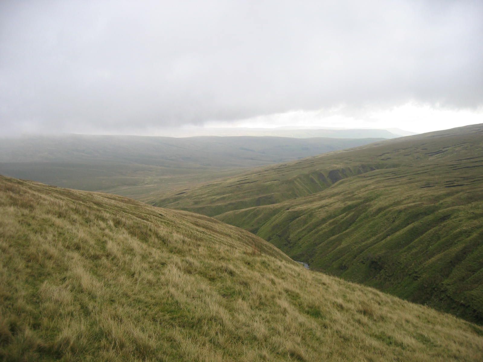
Continue along the edge passing the Nab and reaching a wind break with cairns and a stile. After crossing the stile the path changes direction away from the valley to a more southwesterly bearing and follows the natural contour of the land descending slightly whilst circumnavigating a giant bowl in the landscape to regain a southerly bearing, descending to run alongside a fence. This path can be difficult to spot in mist. Now on the saddle between Wild Boar and Swarth Fells and passing a small tarn now ascend with a wall on the right to get to the rocky outcrop of Swarth Fell [681m]. There are fine views looking back to Wild Boar from this vantage point
Leaving the summit cairn of Swarth the grassy path descends initially across open ground following the ridge converging with the fence on the right and eventually crossing a fence. Now on the other side of the fence looking into Grisedale the path leaves the fence for a short while at a slight bend in the ridge to converge again a short while later. Continue long the crest of the hill with the fence or wall on the left passing a metal bridleway gate. Still with the wall on the left proceed for a further 1/2 mile across Grisedale Common to turn left through a gate. From this point descend quickly across South Lunds Pasture to Grisedale Crossing, a railway footbridge once used by the children from Grisedale on their journey to school. Crossing the railway line walk along the farm access track and thence to the road. Turn right and proceed along the road for 1/2 mile to reach Garsdale House.
For the return walk to Garsdale Station, on leaving Garsdale House turn right and proceed along the main road towards Sedbergh for a very short while then turning left through a gate to follow the recently opened Pennine Bridleway which proceeds directly to the rear of the station passing under Dandry Mire Viaduct enroute. The station is slightly under a mile from the pub and 30 minutes should be allowed for this uphill walk! Remember that southbound trains run from the farthest platform and it is necessary to pass under the road bridge to gain access.


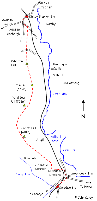
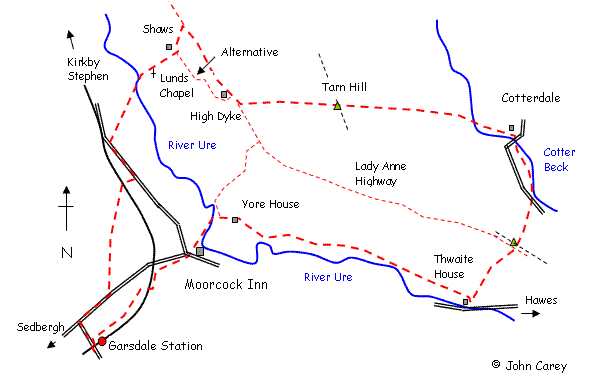
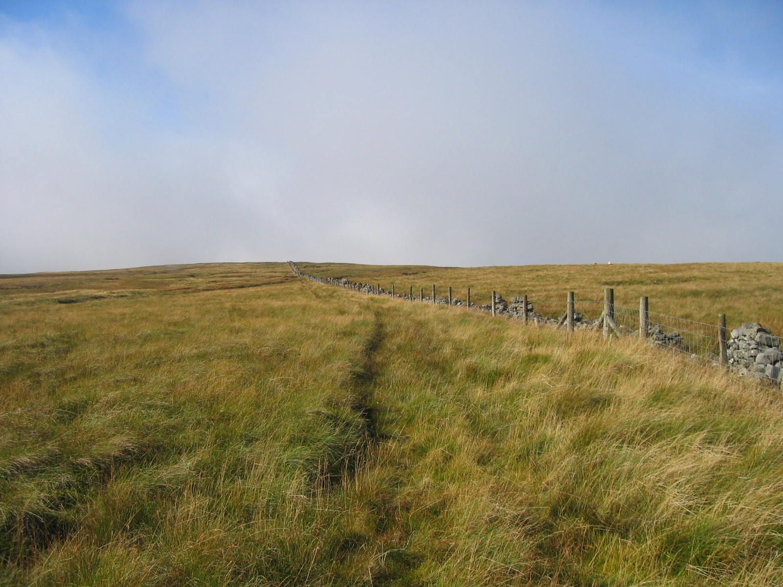
Lady Anne Highway
-
Lady Anne Highway
A fairly easy but long linear walk from Kirkby Stephen Station following the upper Eden valley along Lady Anne Highway, an old coaching road, to Garsdale House and Garsdale Station passing a few points of interest enroute
- 12 miles
- 5 hours
By Car or train - if arriving by car it will be necessary to park at Kirkby Stephen or Garsdale Stations and travel one stop on the train.
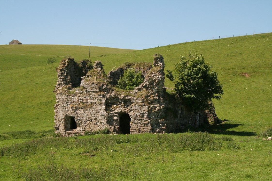
Start at Kirkby Stephen station and pass though the gate off the station access road to follow the footpath downhill and parallel with the road to Kirkby Stephen. At the bottom of the hill at Halfpenny House turn right [due south] along a private road towards Wharton Hall. Just before reaching the hall it is necessary to do a dog-leg to avoid the farm buildings. Turn right at the footpath sign to pass to the right of the buildings and then after passing through a gate turn left and then right to rejoin the farm road just beyond the hall. Continue along the farm road for a short while and at Mire House Bridge turn left passing through a gateway [do not cross the river!]. Follow the left-hand side of the field passing through two small gates and emerging at Lammerside Castle [remains of]. Then proceed slightly downhill with Croop House Farm to the right. Pass through the gate and then immediately turn left through another gate. Follow the bridleway track with the River Eden on the left. The track follows the river for a mile rising slightly uphill until Tommy Road is reached.
At this point a detour is possible to investigate Pendragon Castle. If so, follow the minor road across the river bridge and the castle will be soon reached. The castle stands on a mound and whilst privately owned access can be gained through a gate. Either retrace steps (preferable) or continue along the road through Outhgill to regain the main route beyond Thrang.
Unless the aforementioned detour is taken - cross the minor road along a farm access track. Pass High Cocklake Farm and continue downhill to Sandpot, a private house. The footpath passes immediately to the right of the house itself. Continue across approximately 6 fields and a stream emerging at the quaint hamlet of Shoregill. Bear left down the track towards the river. Before the river bridge turn right and follow the wooded river bank with the river on the left. Pass through some farm building and continue following the river until reaching Thrang Bridge. Cross the river Eden and the 'main' road along the Mallerstang valley and immediately on the other side of road look for a track proceeding diagonally uphill.
This is the Lady Anne Highway rising uphill for the next mile and eventually levelling out at a plateau where an interesting sculpture known as the Water Cut can be found.
Continue along the grassy track for 1 mile to Hell Gill ravine crossing the old stone bridge with impressive ravine below. Continue along the gently undulating 'highway' shortly taking the left hand fork [at a vehicle prohibition sign] eventually with a wall to the right. After 3/4 mile the ruin of High Hall is reached after a ford. Proceed for another 1/2 mile along the highway reaching a gate across the track. There are now two main options for the return.
The easiest route involves passing through the large gate and carrying on along the highway passing High Dyke farmhouse after 1/2 mile. The track then dips into a small ravine and has been subject to landslip in the past. After about 1/4 mile look for a new signpost and gate in the wall. Pass through the gate with a lime kiln on the left. This is the new Pennine Bridleway and is waymarked with wooden posts down to the side of Cobbles Plantation and emerging at Ure Force waterfalls. Cross the bridge and follow the bridleway to reach Garsdale House.
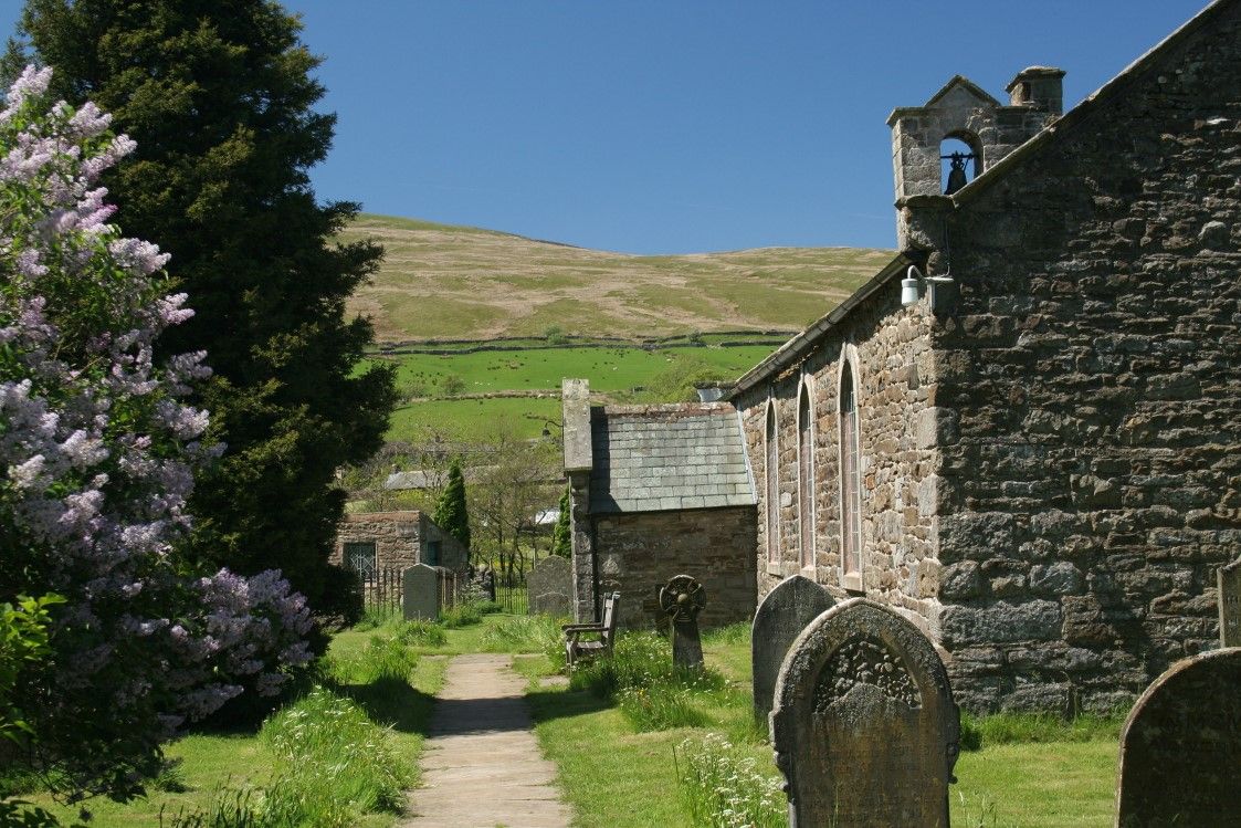
The second option takes in Shaws Waterfall and Lunds Church: Passing through the stile immediately before the aforementioned gate Lady Anne Highway proceed diagonally downhill to a gate at the rear of Shaws and the by steps down to a wooden footbridge in front of the waterfall. Shaws, now a private house was formerly the Garsdale Youth Hostel until the 1970s. Continue downhill across another footbridge and passing through a deserted farmyard to the little hamlet of Lunds with it's now disused church.
Note there are various ways back from Lunds - an alternative more straightforward way is to cross the river by the footbridge at the perimeter of the churchyard and follow plantation access track up to the main road, turn left and thence back to Garsdale House. The downside is 1/2 mile of road walking!
Alternatively:-
Bear left at the church and passing through a stile over Cowshaw Hill and two more stiles. This now becomes difficult to follow and some map reading is required! With the pasture boundary on the right look for a stile at the slight change in direction. Turn right to pass over the stile and then immediately left passing over very rough pasture towards Blades, a small hamlet of cottages. The path has been redirected pass to the left (rear) of the farmhouse through two stiles and crossing a small stream joins the farm access track. At a right hand bend in the track go straight on following the left hand bank of the River Ure. Eventually the path will meet Ure Force waterfalls and an old bridge with it's modern replacement alongside. Cross the bridge and follow the Pennine Bridleway to Garsdale House. Please note that this latter option whilst having the attraction of a visit to Shaws waterfall and Lunds Church can be unpleasantly muddy between Lunds and Blades Farm.
For the return walk to Garsdale Station, on leaving Garsdale House turn right and proceed along the main road towards Sedbergh for a very short while then turning left through a gate to follow the recently opened Pennine Bridleway which proceeds directly to the rear of the station passing under Dandry Mire Viaduct enroute. The station is slightly under a mile from the pub and 30 minutes should be allowed for this uphill walk! Remember that southbound trains run from the farthest platform and it is necessary to pass under the road bridge to gain access.


Cotterdale from Garsdale
-
Cotterdale from Garsdale
A moderately easy circular walk from Garsdale Station or Garsdale House taking in Shaws, the hamlet and remote valley of Cotterdale and return to Garsdale House
- 9 miles
- 4.5 hours
Alternatively this could be done as a circular from Garsdale House which would save 2 miles. By train or car - if arriving by car: park near Garsdale House.
From Garsdale Station walk down to the main Hawes to Sedbergh road and turn right. Walk along the road and after a short while look for a stile on the left [just past the houses]. Follow the path diagonally up hill crossing a couple of stiles and downhill to Lunds footbridge crossing the railway. Do not follow the farm track but walk across the pasture towards the left of the houses.
The direct route goes through the farmyard up to High Dyke via Blades footbridge but I have found this unpleasantly boggy and so I would suggest a detour via Lunds Church and Shaws which is more interesting
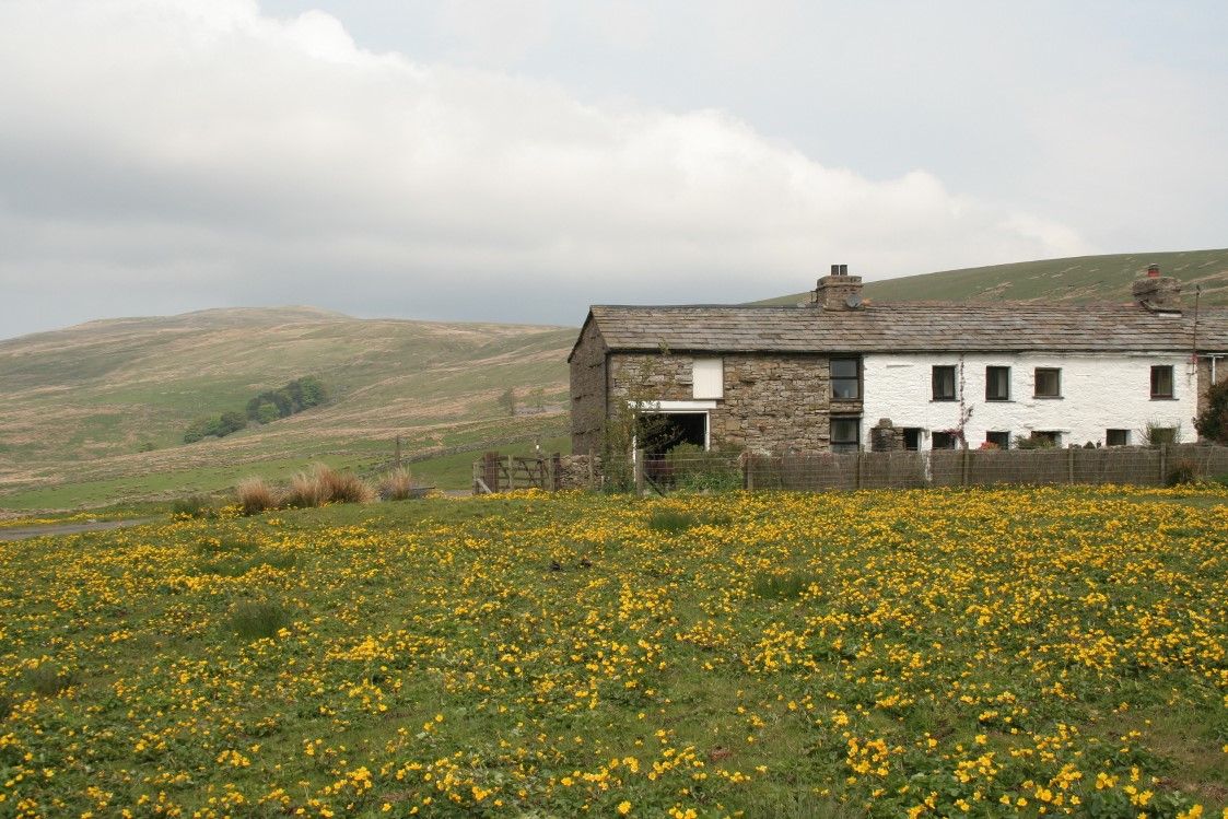
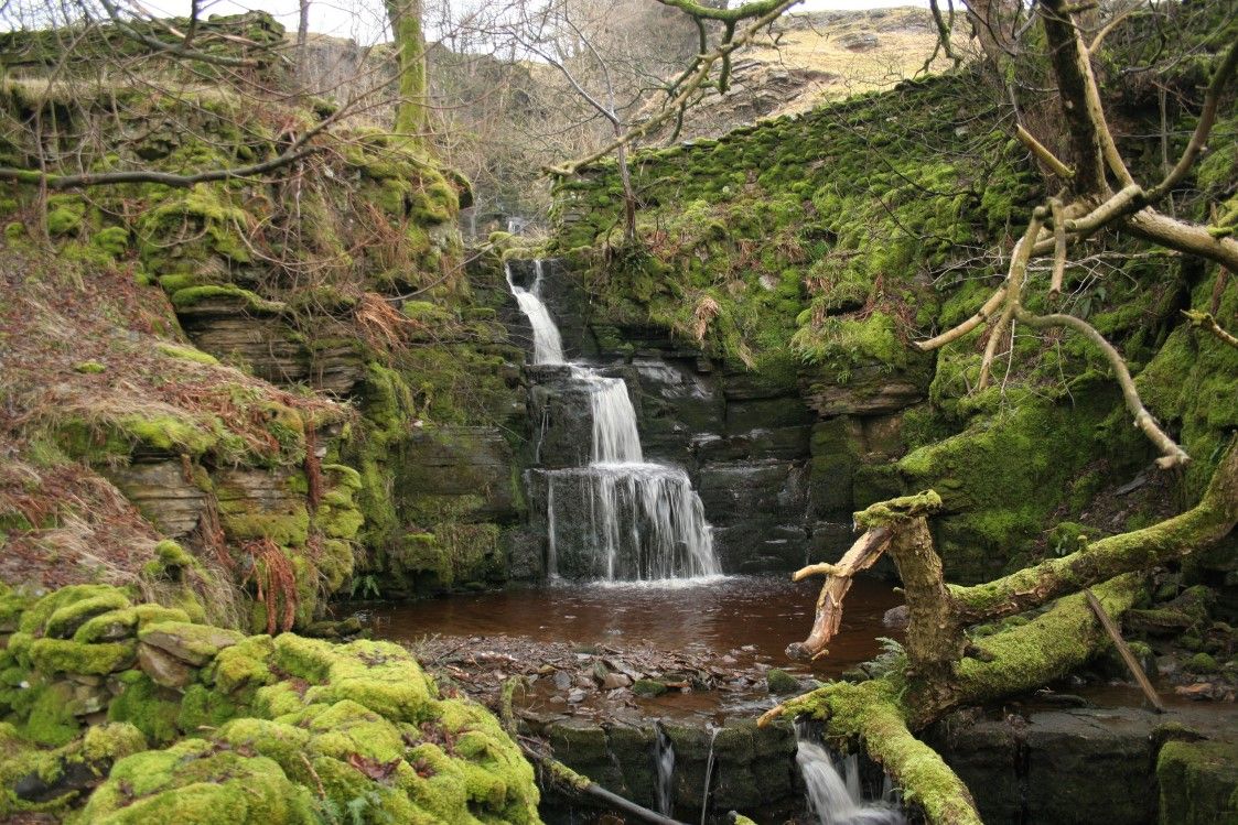
Bear left along the main road for a short distance and look for a stile on the right. The path goes diagonally across two fields and then enters Lunds plantation. The owners have recently felled the trees but the path is well marked although uneven. The owners have installed several bridges across boggy areas. The path emerges at a track. Turn right downhill to cross the River Ure on a foot bridge and immediately into Lunds churchyard [now disused]. Through the top of the church yard pass in front of the farmhouse and through a stile. Cross a footbridge and immediately start climbing uphill with Shaws ravine on the left. Adjacent with Shaws house a decision can be made. Either turn left and pass in front of the scenic waterfall [worth a look] and continue uphill to the track at the top - known as Lady Anne Highway - where it would be necessary to turn right and walk for 1/4 mile to reach High Dyke farmhouse - or climb diagonally up the hillside and directly to High Dyke.
Either way proceed due East from High Dyke along a fairly well defined moorland path travelling uphill to reach Tarn Hill [541m]. Maintaining the same direction continue down hill through the recently felled forest aiming for the river at the bottom. Alternatively the forest tracks could be followed as a zig zag to reach the bottom. At West Gill Beck look for the vehicle bridge slightly upstream from where the path emerges. I imagine that there might have been a footbridge at one time but this has disappeared. Follow the path at the far side of the beck emerging between some farm buildings on the minor road serving Cotterdale hamlet.
Turn right to cross the road bridge and then to follow the the right hand bank of the beck. Follow the beck for no more than 1/4 mile and then bear right, slightly uphill to cross the minor road again. The path proceeds slightly uphill with the plantation on the right, crossing the crest of the hill and then down the other side to emerge at the rear of Thwaite Bridge House Farm.
On reaching the farm turn right passing to the rear of the buildings in a westerly direction and the wall on the right. After a short while the path passes to the right of the wall through a stile. Continue following the wall, Cotterside plantation and through several fields to reach Yore House. Pass through the farm yard and proceed along the farm track and over the River Ure. Immediately over the river bear left and cut diagonally along the new bridleway and to the rear of Garsdale House.
For the return walk to Garsdale Station, on leaving Garsdale House turn right and proceed along the main road towards Sedbergh for a very short while then turning left through a gate to follow the recently opened Pennine Bridleway which proceeds directly to the rear of the station passing under Dandry Mire Viaduct enroute. The station is slightly under a mile from the pub and 30 minutes should be allowed for this uphill walk! Remember that southbound trains run from the farthest platform and it is necessary to pass under the road bridge to gain access.


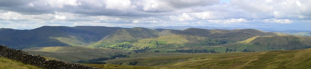
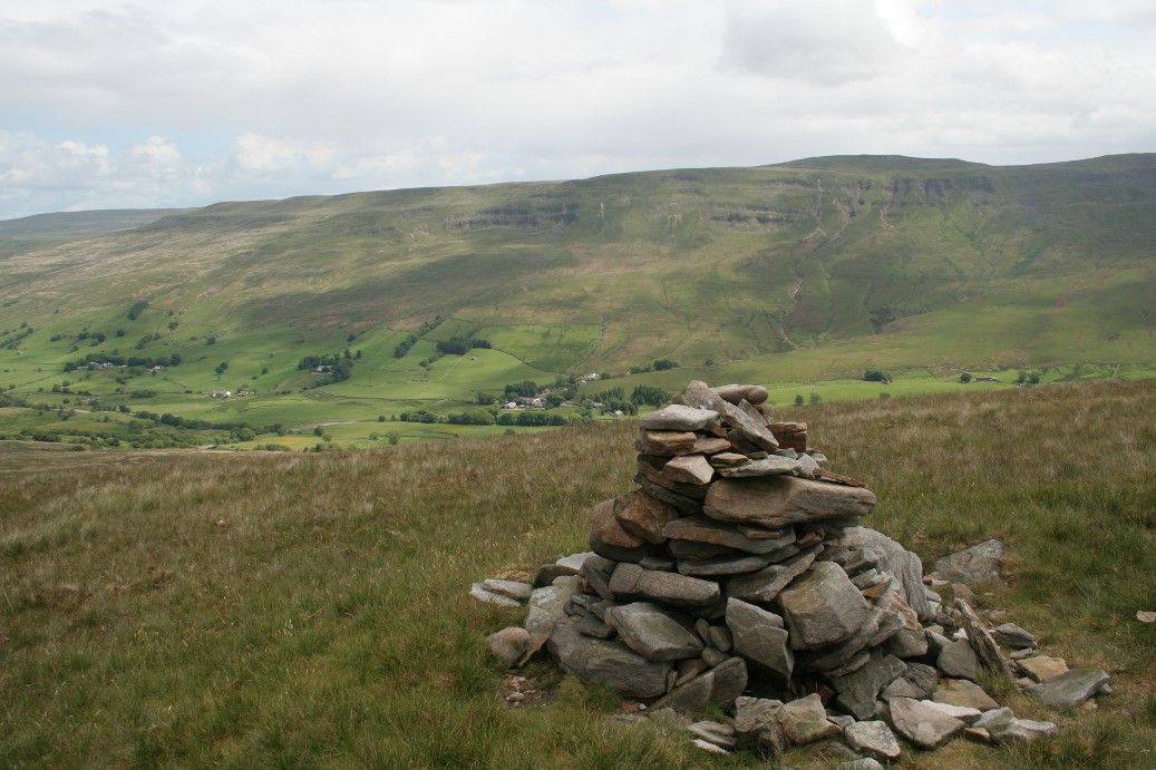
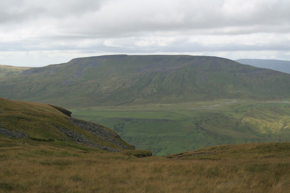
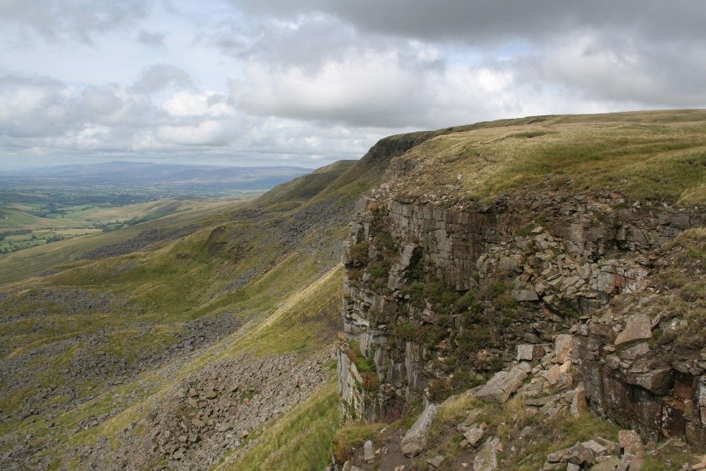
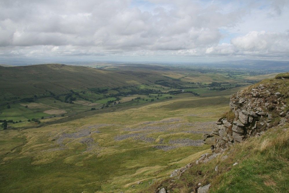
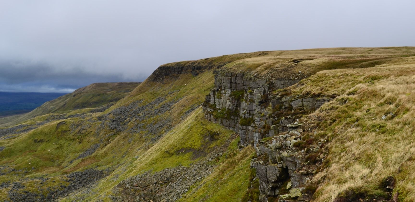
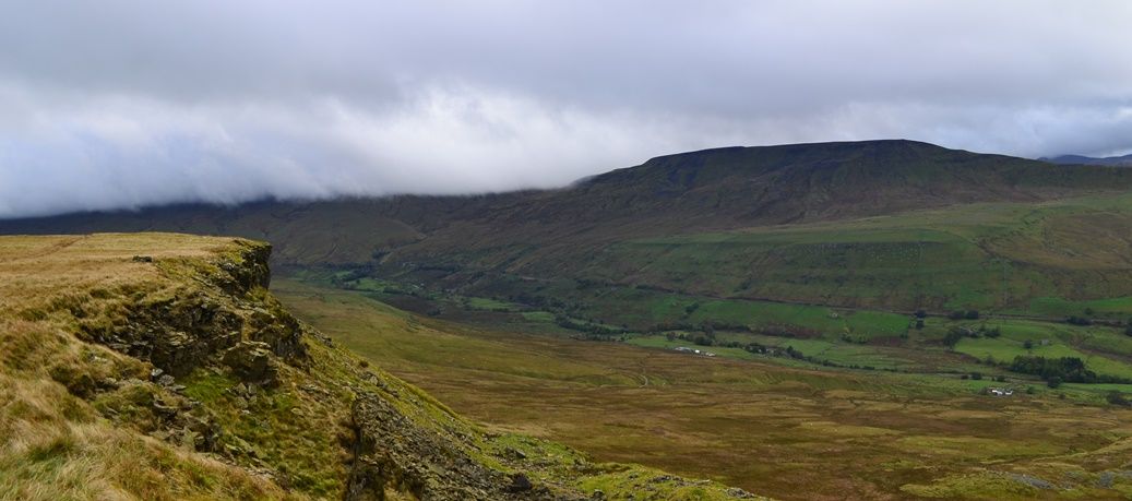
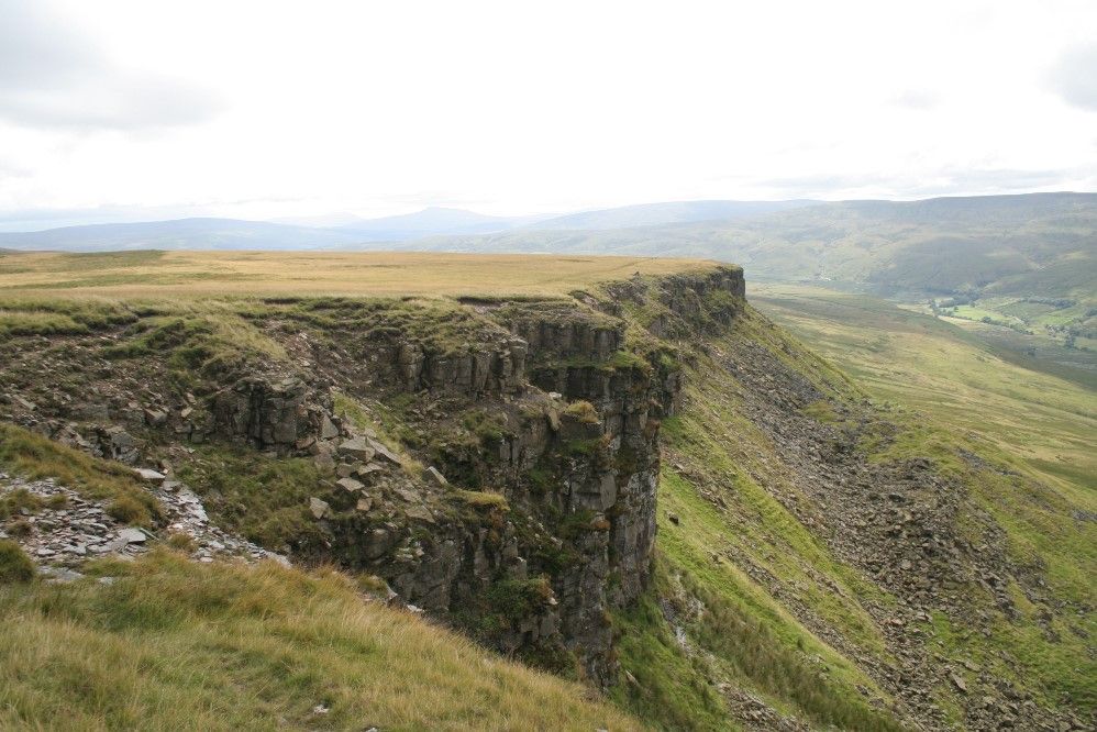
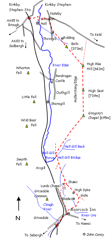
Mallerstang Edge [709m]
-
Mallerstang Edge
A superlative but strenuous high level linear walk from Kirkby Stephen Station to Garsdale House taking in Mallerstang Edge [709m] with some spectacular scenery and good views of Wild Boar Fell
- 13.5 miles
- Allow 6.5 hours
By Car or train - if arriving by car it will be necessary to park at Kirkby Stephen or Garsdale Stations and travel one stop on the train.
Start at Kirkby Stephen station and pass though the gate off the station access road following footpath downhill and parallel with the road to Kirkby Stephen. At the bottom of the hill, at Halfpenny House, turn right along a concrete private road leading to Wharton Hall. Before reaching Wharton Hall turn left and cross a field to a farm bridge across the River Eden. Turn left and immediately through a gate proceed right and uphill to a small gate in the fence. Cross the open pasture towards Nateby village passing to the right hand side of a former school emerging at a minor road serving the Mallerstang valley.
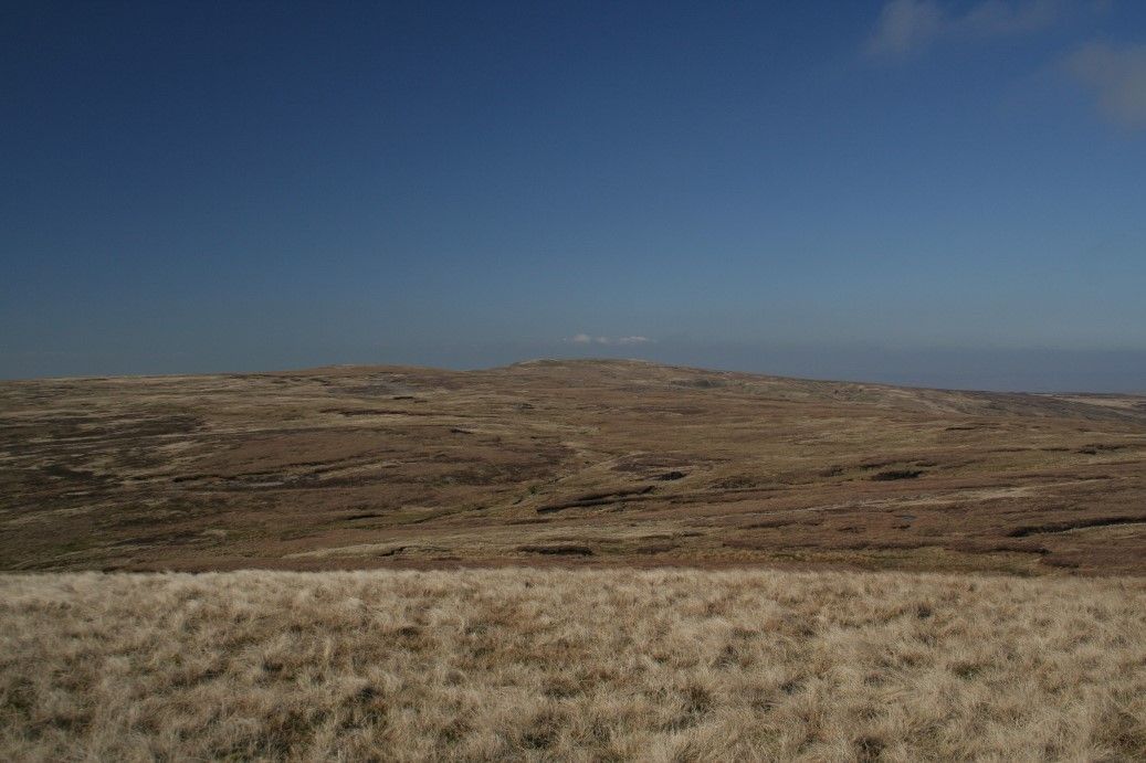
Turn right and proceed along the road for 1/4 mile. Just beyond a lay-by a foot path strikes off to the left crossing several fields passing through a large gate with the wall on the left and then right. This crosses Thringill Beck by a footbridge [actually a mostly dried up ravine] and continues to the right hand side of the ravine now proceeding uphill in a more or less straight line passing the hillock of Bells. From Bells it is necessary to select a line to the summit of High Pike as there is no distinct path. The going is a bit rough and sometimes boggy over open pasture and gets steep, passing the remains of a quarry working before reaching the first summit at High Pike Hill [642m].
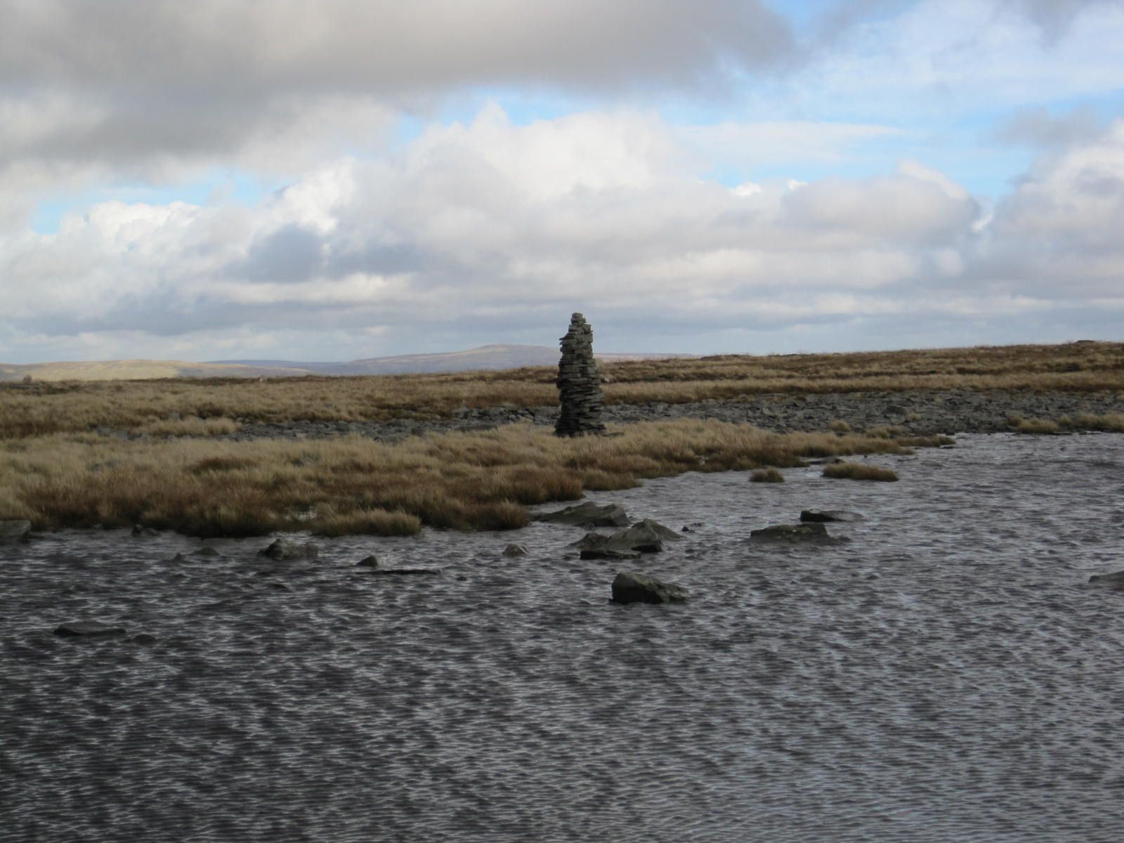
From High Pike follow a faint quad bike track which continues across the plateau rising slightly to get to High Seat [709m]. The views open up at this point and the path drops downhill slightly before ascending to get to Gregory's Chapel [695m]..
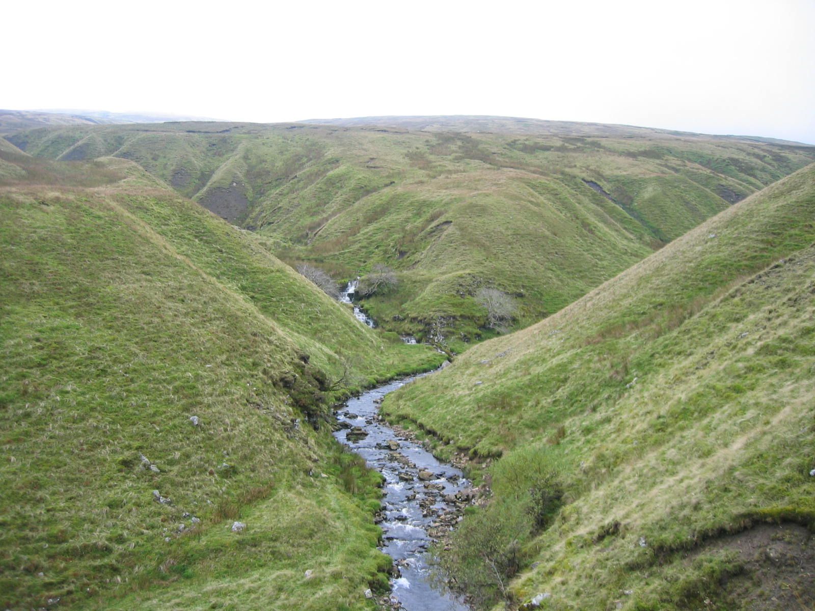
From Gregory's Chapel [actually a pile of stones] bear south west and proceed down the shoulder of the hill passing White Brow and Ravens Nest. This quickly becomes a spectacular cliff edge path along Mallerstang Edge with excellent views towards Wild Boar Fell. After a short while the path will emerge at the side of Hell Gill Beck which is followed all the way down to Hell Gill Bridge.
Turn left to cross the bridge across a very narrow and deep ravine. This track is in fact the old coach road known as Lady Anne Highway. Follow the gently undulating 'highway' eventually with a wall to the right. After 1 mile the ruin of High Hall is reached and a ford. Another 2/3 mile further along the highway there is a gate.
There are two main options for the return from this point. The easiest and preferred option involves passing through the gate and carrying on along the highway for about 2 miles. The track dips into a small ravine and has been subject to landslip in the past and passes the remains of High Dyke farmhouse. About 1/4 mile after the farmhouse look for a new gate in the wall [no sign-post at present]. Pass through the gate with a lime kiln on the left. This is the new Pennine Bridleway and is waymarked with wooden posts down to the side of Cobbles Plantation and emerging through a gate at Ure Force waterfalls. Cross the bridge and follow the bridleway to Garsdale House.
The second option takes in Shaws Waterfall and Lunds Church: Passing through the stile immediately before the aforementioned gate on the Lady Anne Highway proceed diagonally downhill to a gate at the rear of Shaws and the by steps down to a wooden footbridge in front of the waterfall. Shaws, now a private house was formerly the Garsdale Youth Hostel until the 1970s. Continue downhill across another footbridge and passing through a deserted farmyard to the little hamlet of Lunds with it's now disused church.
Whilst there are various ways back from Lunds - the most straightforward way is to cross the river by the footbridge at the perimeter of the churchyard and follow plantation access track up towards the main road. About half way up the track there is a path cutting through the recently-felled plantation and diagonally across a couple of fields to reach the main road. Turn left along the road and thence back to Garsdale House. The downside is 1/2 mile of road walking!
For the return walk to Garsdale Station, on leaving Garsdale House turn right and proceed along the main road towards Sedbergh for a very short while then turning left through a gate to follow the recently opened Pennine Bridleway which proceeds directly to the rear of the station passing under Dandry Mire Viaduct enroute. The station is slightly under a mile from the pub and 30-35 minutes should be allowed for this uphill walk! Remember that southbound trains run from the farthest platform and it is necessary to pass under the road bridge to gain access.


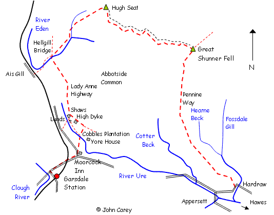
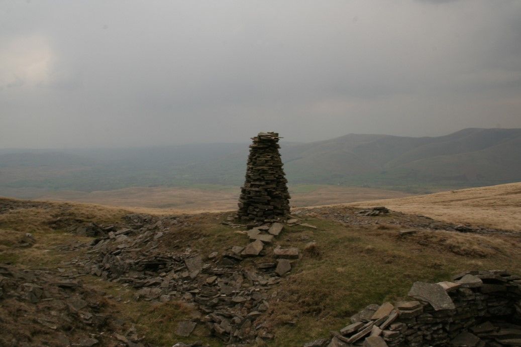
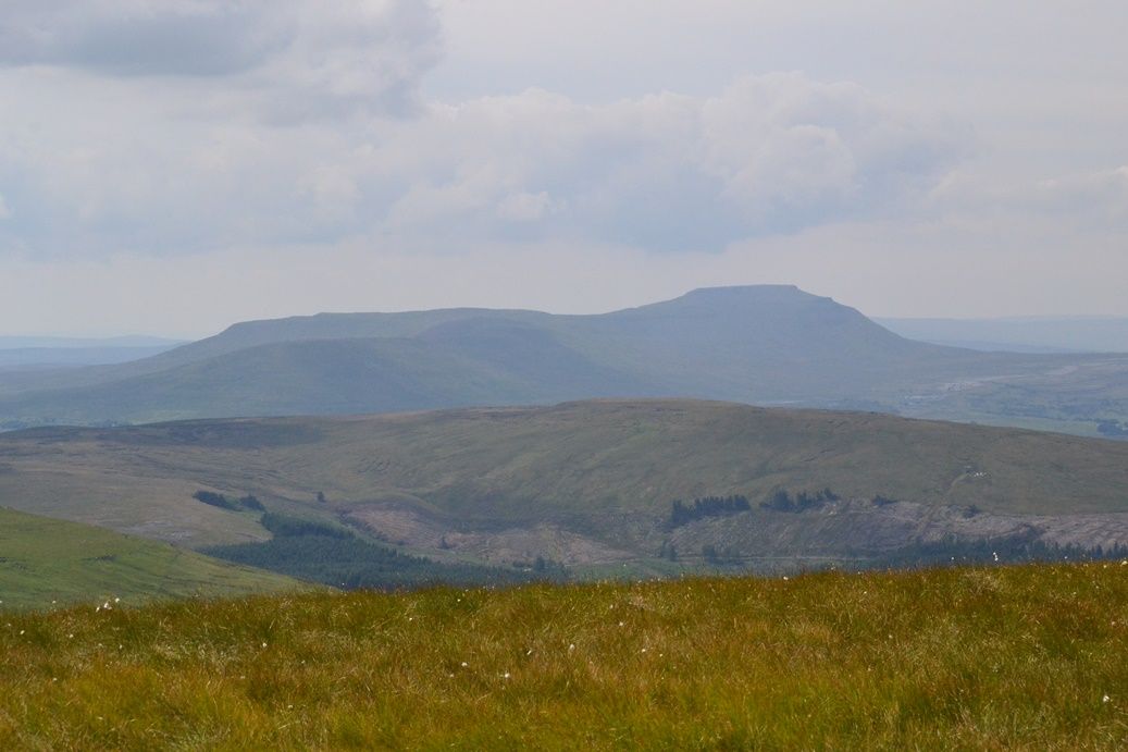
Great Shunner Fell [716m]
-
Great Shunner Fell
An excellent but strenuous day out taking in the peaks of Great Shunner Fell [716m] and Hugh Seat [689m] starting from Hardraw or Hawes and finishing at Garsdale House and on to Garsdale Station
- 12 or 14 Miles
- 6 or 7 hours
By Car or train using the Little White Bus from Garsdale to either Hardraw or Hawes.
This walk starts from Garsdale Station where it is necessary to get the Little White Bus which meets the Northbound and south bound morning trains. Failing that the walk can be started from Hawes following the Pennine Way to Hardraw which will add an extra mile or so. If arriving by car the bus could be picked up near Garsdale House thus saving a further mile.
From Hardraw depart the village in a westerly direction and soon turn right onto the Pennine Way track. Follow the well defined and signposted track for nearly 5 miles ascending gradually all the way to reach the summit windbreak on Great Shunner Fell [716m]. The views into upper Swaledale are excellent. The Tarn seen in the distance is Birkdale Tarn.
From the summit bear due west following a fence on the right. The route is easily followed for the next 2 miles down to a gate known as Market Place negotiating a few boggy bits. Passing through the gate bear slightly right [still with the fence on the right] and continue up to Hugh Seat [694m] although beware of a couple of deceptively boggy bits. The terrain is otherwise quite good. Hugh Seat is an excellent vantage point overlooking the Eden Valley and Wild Boar Fell. Note the date inscription of 1880 in the cairn.
Leave the cairn in a westerly direction heading for a further cairn on the shoulder of hill below with a ravine in the distance - the best plan is to follow the shoulder of hill and descend to where two becks meet crossing one of these to reach the righthand bank. These are in fact the early tributaries of the River Eden. Using a convenient ramp climb to higher ground and proceed with the beck on the left to reach Lady Anne Highway at Hellgill Bridge.
Turn left to pass over Hell Gill and about 1/4 mile further on take the left had fork with the vehicles prohibited sign. Follow the highway for nearly 2 miles passing the remains of High Hall and High Dyke with a gate enroute. After High Dyke dip into a ravine with obvious signs of landslips in the past and after 1/4 mile look for a new signpost and bridleway gate to the right. This is in fact the new Pennine Bridleway. Pass through the gate and follow the timber waymark posts down to Cobble Plantation and ten through a gate. Turn left passing Ure Force waterfall and then right over the old bridge, From here follow the bridleway diagonally across the rough pasture to reach Garsdale House.
There are various routes back to Garsdale House from the Lady Anne Highway some of which I have described on earlier walks. One of these is to descend via Shaws waterfall and Lunds Church either following the rough footpath through Blades or heading for the road,
For the return walk to Garsdale Station, on leaving Garsdale House turn right and proceed along the main road towards Sedbergh for a very short while then turning left through a gate to follow the recently opened Pennine Bridleway which proceeds directly to the rear of the station passing under Dandry Mire Viaduct enroute. The station is slightly under a mile from the pub and 30-35 minutes should be allowed for this uphill walk! Remember that southbound trains run from the farthest platform and it is necessary to pass under the road bridge to gain access.


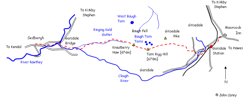
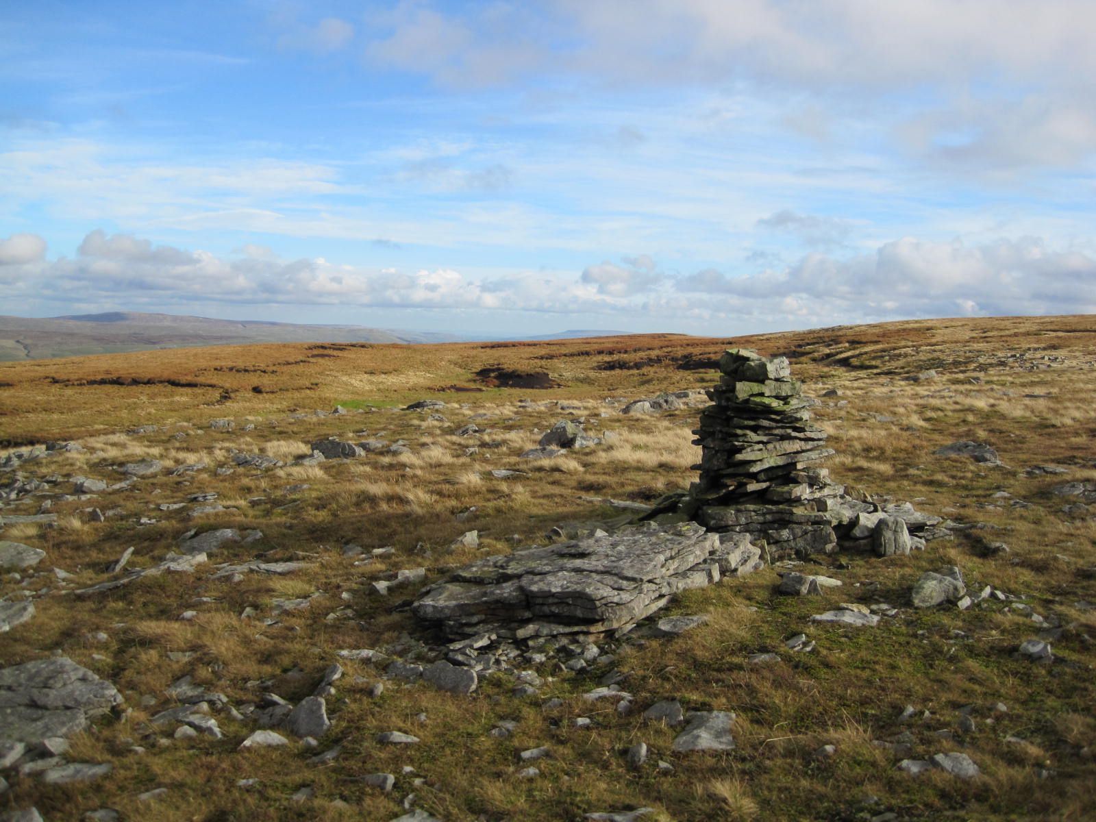
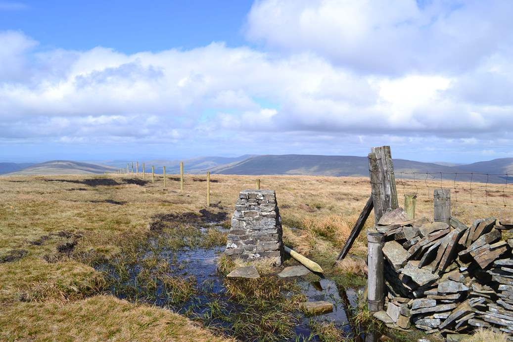
East Baugh Fell [678m]
-
East Baugh Fell
An interesting upland walk with excellent views towards the Howgills, including a traverse of the remote East Baugh Fell [678m], and descent into Garsdale - a good day out! The walk starts in Sedbergh and finishes at Garsdale House
- 11 miles
- 6 hours
By train on Saturdays only.
This walk uses the Dent Station - Sedbergh Western Dales Bus service departing Dent Station at 1020 on Saturdays. For this reason the walk can only be accomplished from the north bound train from Leeds - Carlisle on a Saturday and some Summer Sundays [unless Sedbergh can be reached by another means!]. The return is from Garsdale.
From Sedbergh town centre walk along the main street in an easterly direction. After a few hundred metres turn right along the road to Garsdale. After a short distance turn left at the river bridge to follow the left hand bank of the River Rawthey. After a mile and several stiles the path emerges at Straight Bridge. Cross the road bridge and immediately the other side on a bend take the right hand narrow lane to Garsdale Bridge. Just before the bridge cross the stile and follow the left hand river bank for 1/3 mile or so. Eventually the path strikes out across a field and three stiles to reach Dovecote Gill. Crossing the stile onto the farm track turn right to pass around the side of Dovecote Gill. The track passes through a gate onto open pasture and winds its way up the hill, Emerge at the open fell at the top of the hill.
Pass through the gate and now follow the track with the wall on the right toward Garsdale Foot farmhouse. However, before the buildings are reach a track veers left up the hillside and soon disappears. Follow the fence as it bears right and ascend the hillside to the left of the fence dipping in and out of Ringing Keld Gutter. A wall appears on the right and the going gets steeper eventually emerging at the top of the fell. It is a short walk from here to reach the trig point at Knoutberry Haw [676m]. Continue with the wall on the right for 1.5 miles passing Tarn Rigg Hill [678m]. Maintain the left hand side of the wall/fence passing several small tarns. Eventually the view will open out across Dandry Mire Viaduct and Wensleydale forming the distant vista. Start descending all the time with the wall/fence on the right eventually to cross a beck at the bottom and then a short while further on to meet the minor road serving Grisedale.
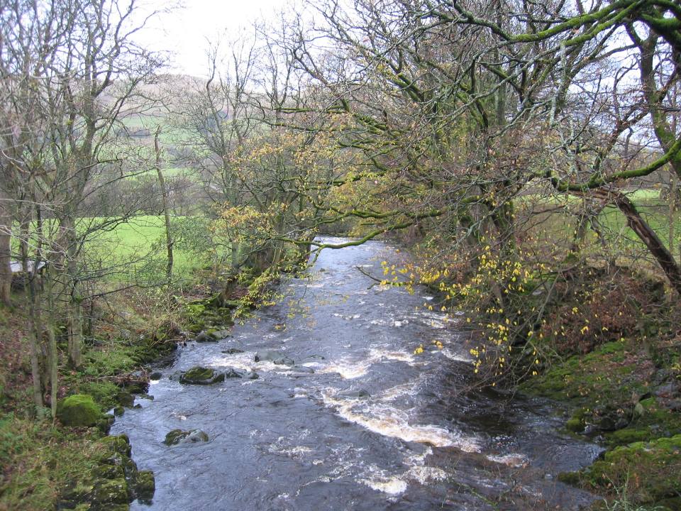
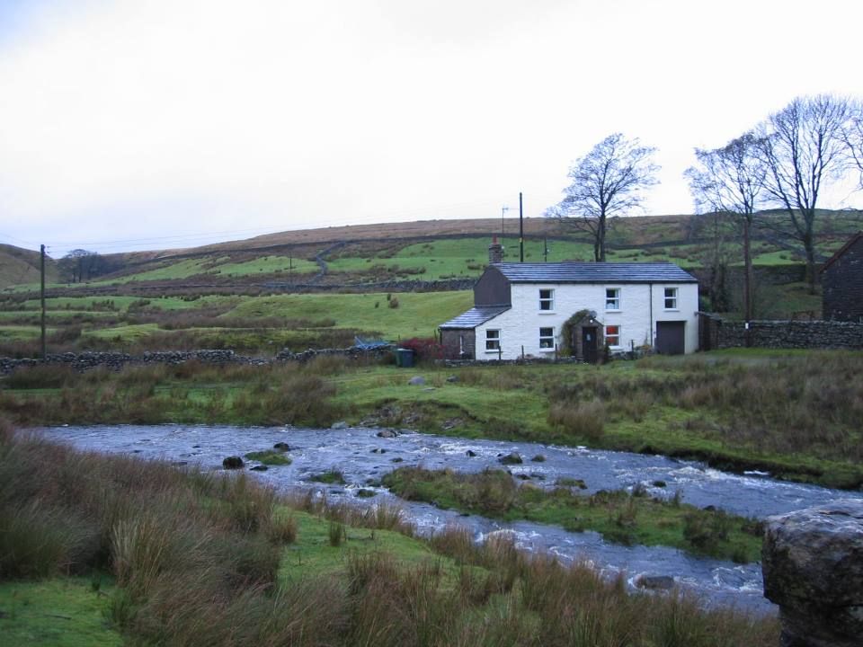
Turn right along the minor road. At the T junction turn right for a short while and after 100m turn left through a gate dropping down hill to cross two stiles. The path then drops steeply down to the Clough River and a farm bridge at Low Scale farmhouse. Cross the main Hawes - Sedbergh road and through a farm gate bearing left cross the pasture. Pass through two stiles turning sharp right uphill alongside a small beck to reach High Scale. The path curves left more or less on the level to parallel the railway line all the way now to Garsdale Station emerging at the Coal Road just below the cottages.
Either go directly to the station to proceed along the new bridleway immediately below the cottages. This passes under Dandry Mire Viaduct and soon reaches Garsdale House.
For the return to Garsdale Station retrace steps along the Pennine Bridleway or catch the Little White Bus! The station is slightly under a mile from the pub and 30-35 minutes should be allowed for this uphill walk! Remember that southbound trains run from the farthest platform and it is necessary to pass under the road bridge to gain access. See Dales Bus for bus times.


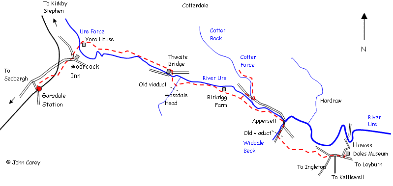
Hawes to Garsdale House via Cotterdale
-
Hawes to Garsdale House via Cotterdale
An easy linear walk suitable for families taking in Hardraw and the remote hamlet of Cotterdale
- 9 miles
- 4.5 hours
The walk makes use of the Little White Bus service from Garsdale to Hawes. A possible deviation can be made at Hardraw to visit Hardraw Force where a small charge is payable at the Green Dragon public house. Alternatively the walk could be done in reverse parking at the Dales Countryside Centre in Hawes.
From Garsdale Station or Garsdale House take the Little White Bus into the centre of Hawes. From Hawes Market Place walk towards Leyburn crossing Gayle beck and turn left towards the Dales Countryside Centre. Follow the road across the old railway bridge and on the other side the flagged path leaves the road for a short while on the left. The road is rejoined just before the bridge over the River Ure. Follow the road and after a slight uphill take the Pennine Way footpath on the left [near a row of trees]. Follow the path across a number of fields emerging at the back of Hardraw near the Green Dragon pub. There is also a useful tea room here if time permits.
Cross Hardraw Beck on the road bridge and immediately after the old school building turn right following the Pennine Way signs again. This track weaves its' way slightly uphill and after 3/4 mile take the left hand path signposted Cotterdale. This follows the contour across several fields descending slightly. Keep an eye open for a small gate on the left after 1/2 mile where the path turns left and right. A footpath sign will be seen. Don't cross the small stream immediately ahead but bear right with the fence on the left. At the end of this rough pasture cross a small bridge and pass through a stile proceeding to reach the minor road through Cotterdale. Turn left along the lane passing several cottages and farm buildings with East Gill Beck on the left. At a bend in the road and before the main road bridge across Cotter Beck turn left still with stream on the left. Follow the right hand bank of the stream for a short while and cross West Gill beck by means of a foot bridge.
Proceed across the field and where the path meets the river again turn right slightly uphill to pass through a stile and continue uphill again to the minor road, Cross the minor road and continue diagonally uphill, crossing a stile. At the shoulder of the hill turn right in front of a wall to join the Lady Anne Highway and proceed steeply uphill through a gate and passing a lime kiln. There is a handy bench just above.
Follow the track on the level with the wall on the left. The views are impressive and it is well worth getting to this vantage point. Pass through a gate. As the path turns to the right and descends slightly look for a new gate in the wall. Pass through the gate on the new Pennine Bridleway. The path is well marked with timber posts and descends the hillside towards Cobbles Plantation and Ure Force Waterfalls. Pass through the gate at the bottom and turn left and then right across the farm access bridge. . Immediately over the river bear left and cut diagonally along the new bridleway and through a gate to the rear of Garsdale House.
For the return walk to Garsdale Station, on leaving Garsdale House turn right and proceed along the main road towards Sedbergh for a very short while then turning left through a gate to follow the recently opened Pennine Bridleway which proceeds directly to the rear of the station passing under Dandry Mire Viaduct enroute. The station is slightly under a mile from the pub and 30-35 minutes should be allowed for this uphill walk! Remember that southbound trains run from the farthest platform and it is necessary to pass under the road bridge to gain access.


Hawes to Garsdale House via Mossdale Head
-
Hawes to Garsdale House via Mossdale Head
An easy low level linear walk suitable for families from Hawes to Garsdale station with an option to visit Cotter Force
- 7.5 or 8.25 miles including the waterfall
- 3.5 hours
The walk makes use of the Little White Bus service from Garsdale Station to Hawes. Alternatively the walk could be done by parking at the Dales Countryside Centre in Hawes and getting the bus back from Garsdale House which would save a mile.
From Garsdale Station or the Garsdale House take the Little White Bus into the centre of Hawes. Alighting the bus at the Dales Countryside Museum walk up the main street through Hawes passing the road junctions to Kettlewell and Ingleton. After 1/4 mile turn left up the farm track opposite Ashes. At the top of the track by some farm buildings pass through a gate and bear right crossing a small stream by a ford. Pass through a stile at the other side of the field and turn left with the wall on the left and then pass through 2 stiles.
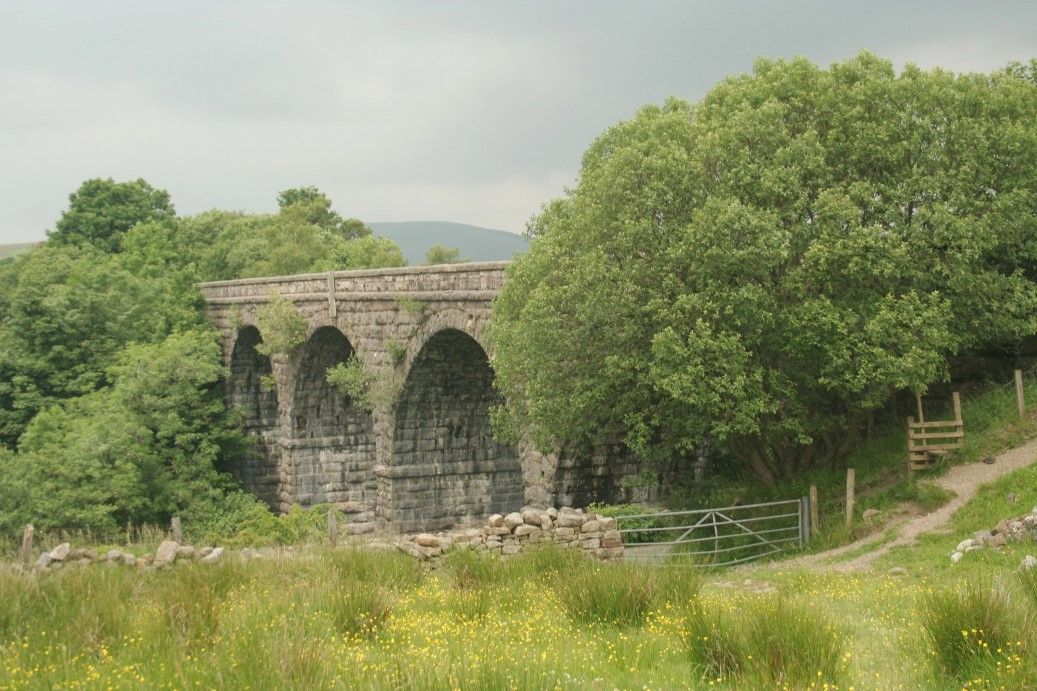
After 300m or so bear right across open pasture. There is a waymark in the middle of the field. Pass through a stile and head for Appersett Viaduct. Cross the stile to emerge at the minor road. Turn right and follow the minor road under the viaduct and down to Appersett. Bear left and cross the road bridge over Widdale Beck. Immediately on the far side of the bridge pass through a stile on left and follow the main road to New Bridge. The path turns left just before the River Ure and follows the left hand bank through woodland and then pasture. After two stiles and a slight uphill the path turns right over a stile [easily missed] and passes diagonally downhill through the woodland and crossing and small stream. Proceed across the meadow land for 500m or so eventually picking up a farm track near a barn.
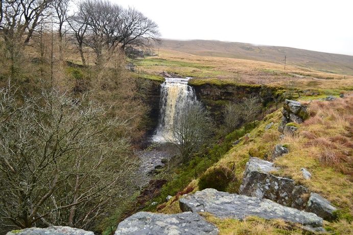
At this point a deviation can be made to visit Cotter Force adding 3/4 mile. Bear right along track crossing River Ure to meet main road. Turn right along main road for 400m or so crossing Cotter Beck. Immediately after the bridge turn left on to footpath [signposted Cotter Force]. Continue for 1/4 mile until reaching the waterfall. Retrace steps to main road, crossing River Ure to regain farm track and continue earlier route.
After 1/4 mile or so take the left hand fork rather then the track to Birkrigg Farm. As the track veres sharply left continue almost straight ahead across meadow land and two gates eventually reaching a gate at the side of Mossdale Farm.
The path emerges between the farm buildings. Continue along the farm track crossing Mossdale Gill. Look out for the impressive waterfalls under Mossdale viaduct. Pass through a farm gate. Bear right and slightly uphill following the waymarks. The path then descends to cross the main road at Thwaite Bridge.
Walk towards the farm and through large double gates at the right hand side of the buildings bearing left. Continue in a westerly direction. Cross a field into a larger pasture with the wall on the right. After a short while the path passes to the other side of the wall through a stile [easily missed]. Continue following the wall with Homesett Scar woodland on the left. Pass through a stile and a large open pasture. Pass another stile below Cotterside Plantation and yet a further stile. The path now joins a farm track to reach Yore House. Pass through the farm yard and proceed along the farm track and over the River Ure at Ure Force. Immediately over the river bear left and cut diagonally along the new bridleway and through a gate to the rear of Garsdale House.
For the return walk to Garsdale Station, on leaving Garsdale House right and proceed along the main road towards Sedbergh for a very short while then turning left through a gate to follow the recently opened Pennine Bridleway which proceeds directly to the rear of the station passing under Dandry Mire Viaduct enroute. The station is slightly under a mile from the pub and 30-35 minutes should be allowed for this uphill walk! Remember that southbound trains run from the farthest platform and it is necessary to pass under the road bridge to gain access.


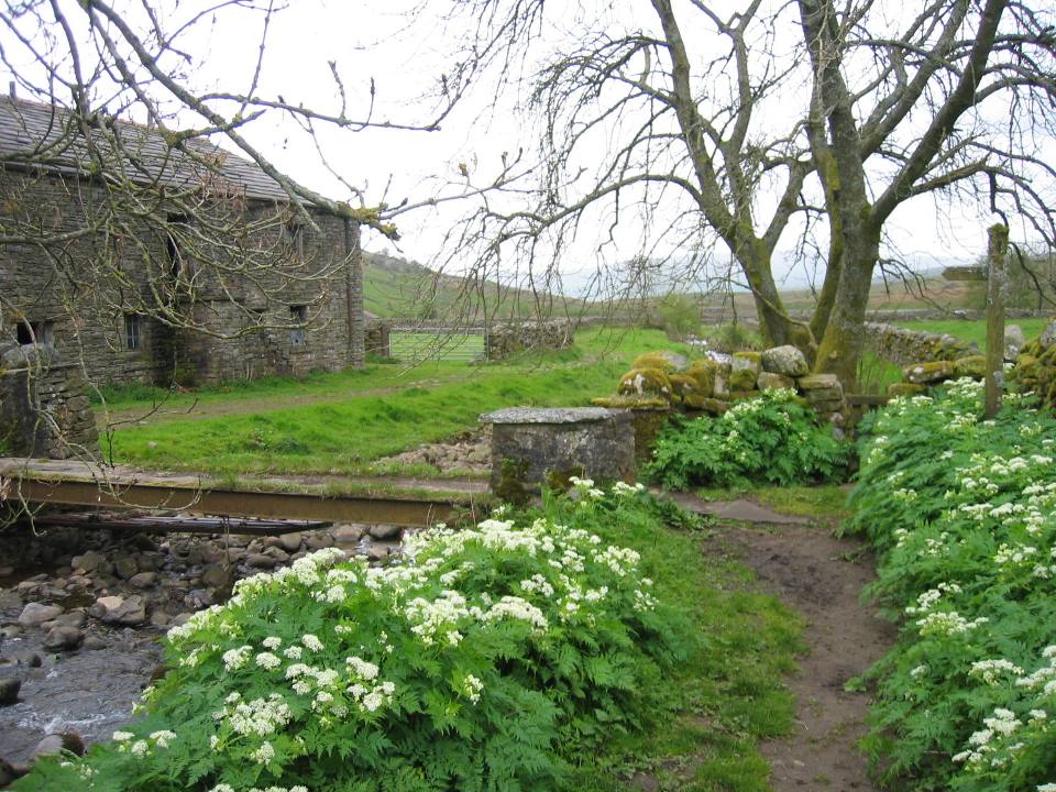
A Short Grisedale Circuit - Garsdale House
-
A Short Grisedale Circuit
A short circuit of Grisedale with limited exposure paced with interest and suitable for families starting from Garsdale House or Garsdale Station taking in this remote valley and the deserted hamlet of Scales
- 6 miles
- 3.5 hours
If starting from Garsdale House follow the main road towards Sedbergh under the railway bridge to the T junction serving the station and turn right through stile. This is in fact the 2nd stile on the right hand side directly opposite the turning to the station. Then pick up the directions below.
Alternatively, if arriving by train from Garsdale Station walk down to the main road to the T junction. Immediately across the main road look for a stile and climb uphill. After the 2nd stile the ground levels out slightly. Pass to the rear of Blake Mire and through a stile to the right hand side with a sign 'Beware of the Farmer'. Proceed across the pasture to Rowantree now occupied by a few hen coups and the onwards across the pasture to Moor Rigg. The pasture is full of wild flowers in May and June.
Cross the minor road at Moor Rigg and pass through a stile, across two fields and another stile to emerge proceeding to the right hand side of Reachey, a renovated farmhouse. The path now follows the right hand side of the Clough River for some way. Continue until reaching the old stone bridge at Scales. It is worth pausing for a look around the deserted former Quaker community and its graveyard within the trees. Until a few years ago this was to be renovated as part of grandiose plans to turn into a recording studio and residence by the band Erasure - but now abandoned. Indeed it may be From Scales retrace steps over the bridge and take the vehicle track up the hill to Flust to join the track to East House. In recent years I have found this preferable to the alternative path to Ings (easier route finding and less boggy!)
At the barn at Flust follow the track through a ford and to the rear of East House. The path now crosses the upland pasture of Grisedale Common on which wild ponies can usually be seen. The path steadily curves around to the shoulder of the hill where there is a stile and a gate. Look carefully for these as they are midway along the pasture and might be difficult to spot immediately.
Passing through the gate descend across South Lunds Pasture pasture taking an almost diagonal course towards Grisedale Crossing and footbridge which can be seen below. Eventually, cross the railway track by means of the footbridge and proceed along the access road. Cross the main road and proceed along a track towards Blades farmhouse. After crossing the River Ure on a vehicle bridge bear right and follow the left hand bank to Ure Force waterfalls.. After crossing the bridge keep to the bank for a short while and it should be possible to see the recently constructed bridleway striking out diagonally across the rough pasture to arrive at the rear of the The Garsdale.
For the return walk to Garsdale Station, on leaving Garsdale House turn right and proceed along the main road towards Sedbergh for a very short while then turning left through a gate to follow the recently opened Pennine Bridleway which proceeds directly to the rear of the station passing under Dandry Mire Viaduct enroute. The station is slightly under a mile from the pub and 30-35 minutes should be allowed for this uphill walk! Remember that southbound trains run from the farthest platform and it is necessary to pass under the road bridge to gain access.
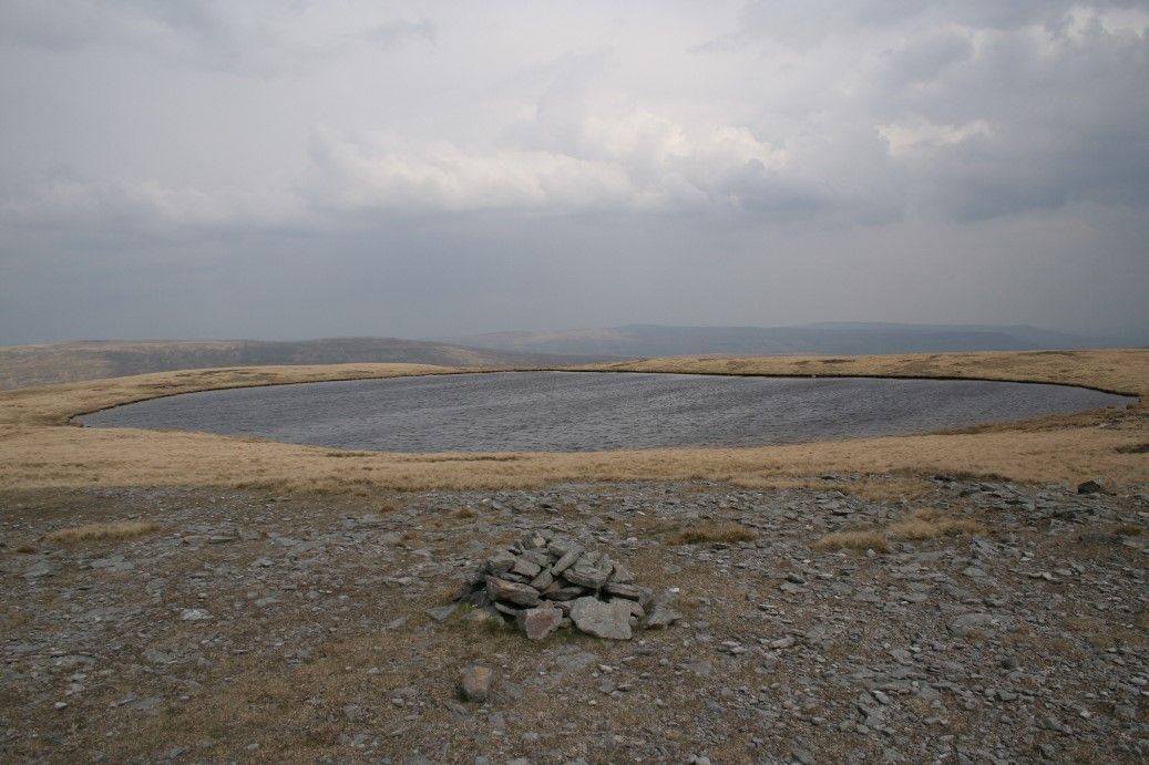
Baugh Fell Circuit [678m]
-
Baugh Fell Circuit
A strenuous upland circular walk with excellent views towards the nearby hills taking in remote East Baugh Fell [678m] West Baugh Fell [639m], Baugh Fell Tarn and the isolated Grisedale valley- a good day out and most unlikely to see anybody!
- 12 miles
- 6 hours - By car or train from Garsdale Station or Garsdale House.
Note of caution: Please take care crossing Rawthey Gill when in spate or after heavy rainfall! If in doubt it would be better to make a descent to the side of Hashkaw or Swere Gill and thence on to Grisedale
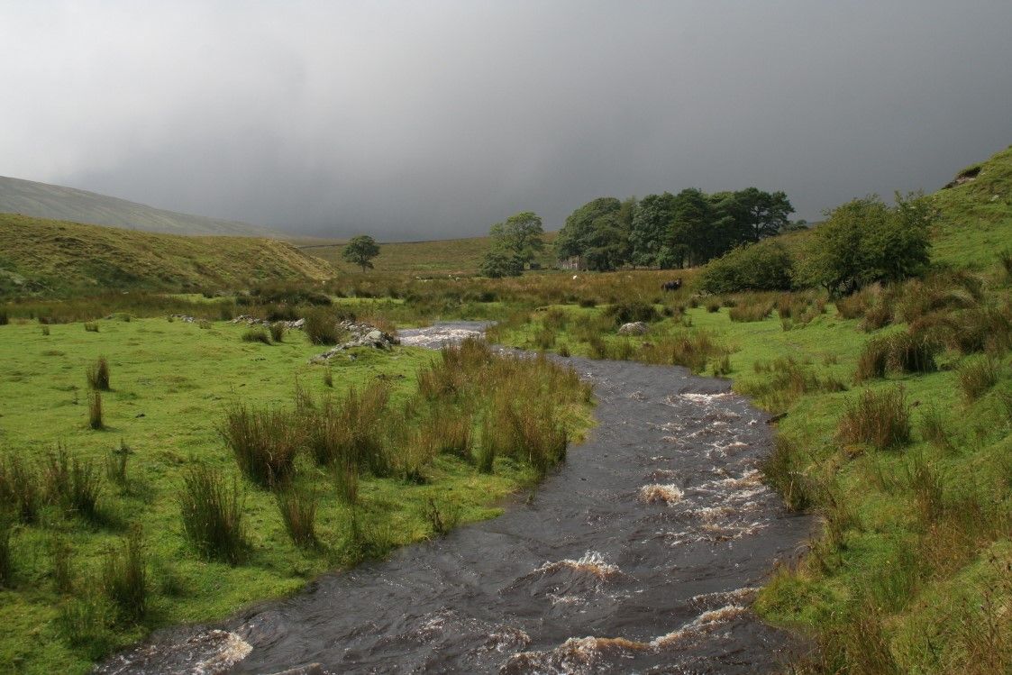
From Garsdale Station descend to the main Hawes - Sedbergh road and turn left. Turn right after 300m or so to follow the single track road into Grisedale. After 1/2 mile turn right at the T junction to follow another minor road. There are two options. The first is to turn left on to the heather moorland at near the crest of the hill. This is immediately opposite a lay-by. From here proceed uphill for a short distance eventually following a wall around the contour of a small hill. Upon rounding the hill descend through a gateway to cross a small stream. Then follow the left hand side of the wall to the top of of East Baugh Fell.
Alternatively: If following the second option walk along the minor road for a further 1/4 mile to a cattle grid and turn left to climb uphill with the wall on the left over the small hill. Cross the stream and follow fence/wall all the way to the top. Then follow directions as described above
On reaching the top pass through a gate to the other side of the wall. Proceed with the wall on the left soon reaching the highest point on the fell Tarn Rigg Hill [678m]. At this point a slight detour can be made to look at the East Baugh Fell Tarns and the view down into Grisedale. There are quite a few channels in the plateau which make a circuit of the top difficult. It is best to retrace to the wall before continuing. Otherwise continue alongside the wall to reach the trig point at Knoutberry Haw [676m].
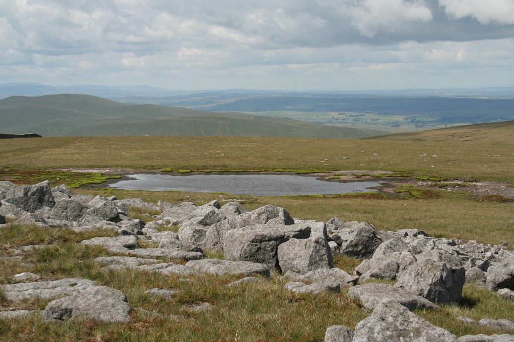
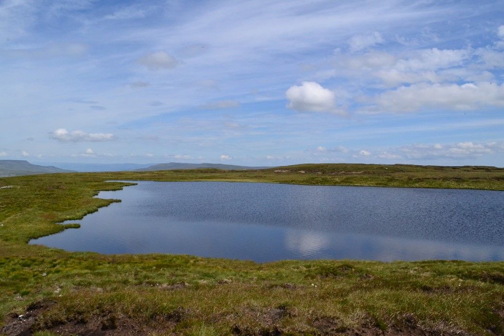
After another 400m or so bear right on to the open plateau of West Baugh Fell. Navigation could be difficult in cloud as there are no walls. However pass through the remains of an old quarry and continue due north for a short while where West Baugh Fell Tarn should come into view.


Sedbergh to Garsdale
-
Sedbergh to Garsdale
A low level linear walk without particular difficulty following Garsdale and the Clough River from Sedbergh to Garsdale House
- 11 miles
- 5 hours
By train to Dent Station then Saturdays only Western Dales Bus to Sedbergh. This walk can only be easily accomplished from the northbound 0849 ex Leeds train service unless a lift can be arranged. This involves some road walking at the very least and this can be varied depending on preference as the footpaths parallel the Sedbergh-Hawes main road all the way. Indeed, the short field sections at Hole House, Blades and Cross Thwaite could be omitted to save time or adverse muddy conditions.
Alight the train at Dent Station. Take the Saturday only from, Dent Station - Kendal bus and alight in the centre of Sedbergh. This is an excellent service. Remember that the bus may not wait longer than 10 min for a late running train and so it's advisable to have a contingency plan in mind. Perhaps do the walk in reverse starting at Garsdale if the train is running late.
Walk along the main street and along the main road towards Kirkby Stephen for a short distance. Turn right on to the main road towards Hawes and the River Rawthey at New Bridge. Immediately before the bridge turn left and follow the river bank passing through several gates to emerge at Straight Bridge. Cross the road bridge and immediately turn right along the narrow lane emerging at Garsdale Bridge. Before the bridge turn left across a stile following the riverbank as it twists an turns passing through several stiles/gates on the way. Do not be tempted to cross the river at the footbridge enroute. Eventually, the path strikes off left of the river climbing slightly across a field with a waymark in the middle, towards a stile and thence to the minor road serving Dovecote Gill. Passing to the right of the entrance to the house follow the track through a gate and then around the hillside climbing slightly uphill eventually to meet the fell edge. Passing through a gate turn right and proceed with the wall on the right to Garsdale Foot, joining a minor road.
At this point turn right and continue downhill along the minor road for 250m or so. Carry straight on at the T junction and after 400m bear right along track to Hole House passing through a gate just beyond the farm and pass across a field to reach Stephen's Farm. The path goes to the right of the farm. The going can be very unpleasant and muddy in wet weather around the farm. If indeed the weather is wet it might be better to stay with the aforementioned minor road which will eventually emerge at the main road below. However assuming the path across the fields is taken, continue on the same line across two more fields to arrive at the buildings of a disused fish farm. Turn right immediately and do not try to cross the stream in front. There are no way marks but follow track downhill towards the River Clough following the river bank and on to meet the main road and another 'New' Bridge. If following the road option turn right along the main road for 100m or so and then left on the farm access road to meet the river.
Cross the main Hawes-Sedbergh Road and now follow left hand bank of Clough River for the next mile or so. Resist the temptation to try and rejoin the main road at Swarthgill. Continue on to join main road at Aye Gill. Follow the main road for 400m and just after passing Slack Cottage look out for a foot path sign on the left. Pass across a field and to the left of the farm buildings at Low House and Blades Farms following the way marks to rejoin the main road briefly at Smarthwaite and the river bridge.
However, keep to the left of the river and pass through the gate and the farm track to Roger Pot. The path follows the river but after passing to the rear of a cottage resist the temptation to walk into the trees [there is a false path at this point!]. Instead clim to the higher ground above the trees crossing a small stream and through a stile. This passes through a private garden and on to West Paradise Nursery [this is the name shown on the OS map - I don't know if it applies to the farm itself]. Immediately after the white farm buildings bear right and through a gate behind a barn.. There are no waymarks. Pass through a small sheep enclosure. This path now continues on to Weggs at the last minute bearing right along the plantation track to rejoin the main road crossing the Clough River by means of the farm/ plantation access bridge.
Continue along the main road for 200m and bear right at footpath sign for Cross Thwaite. A preferable alternative here is to stick with the road as this path is little used. Just before the farm building bear left across fields and pass to the rear of Raygill through a ford. Unfortunately the farm is a bit of a scrapyard. There are no waymarks but the path passes between two buildings and thence down hill to reach the main road. Bear right along the main road towards Hawes. After 150m bear left on to the Old Road which provides access to the remote valley of Grisedale. The Old Road is certainly to be preferred to the main Hawes road and runs parallel at a slightly higher level. Either stay with the Old Road or bear right through a gate after 500m crossing several fields to emerge at Low Scales farm and farm access bridge across the river. Cross the main road again and passing through a gate bear left to proceed across two fields almost parallel with the road but passing through a stile after the 2nd field turn right to proceed up the hill at the side of a stream. Turn left in front of High Scale and then across 3 fields to emerge just below Garsdale Station. Continue along the Pennine Bridleway to the left of the cottages to reach Garsdale House.
For the return walk to Garsdale Station, on leaving Garsdale House turn right and retrace steps along the Pennine Bridleway unless the opportunity is taken to use the Little White Bus. The station is slightly under a mile from the pub and 35 minutes should be allowed for this uphill walk! Remember that southbound trains run from the farthest platform and it is necessary to pass under the road bridge to gain access.


The Highway Circular
-
The Highway Circular
An easy circular walk from Garsdale Station taking in some elevated views from The Lady Anne Highway and returning via Garsdale House - a good day out and not too taxing!
- 8.5 miles
- 4 hours
By car or train from Garsdale Station or Garsdale House. Alternatively this walk can be started from Garsdale House in which case the length will be approx 7 miles.
From Garsdale Station turn right almost immediately and proceed along the new Pennine Bridleway passing under Dandry Mire Viaduct and emerging at the main road and T junction opposite Garsdale House. Turn left along the Kirkby Stephen Road and then immediately right to follow the bridleway to Ure Force Bridge. Take the right hand track up to Yore House Farm. Pass through the farm yard and a gate to the left of the farm. Cross a small stream and continue across the rough pasture towards Hawes running parallel to the River Ure and passing through 4 stiles and to the right of Cotterside Plantation. After crossing the 4th stile look for a stile midway along the wall and cross to the other side of the wall. This can be easily missed! Continue across two further fields to emerge in the farmyard at Thwaite Bridge Farm.
Immediate out of the farm and on to the old road turn left to climb steeply uphill through the copse. Cross a stile and after the second stile on the crest of the hill now turn left. This is the Highway. Continue along the Highway for 3 miles. The going is very easy apart from 1 dip just before High Dyke and the views are good.
There are two opportunities to descend and shorten the walk the first being shortly after the plantation where the new Bridleway cuts in. This will go straight back to Ure Force. The second possibility is the path descending from High Dyke which descends to Blades Farm and then on to Ure Force.
Otherwise if attempting the full walk continue past High Dyke for 1/2 mile and over a footbridge. Just after there is a large gate. Immediately through the gate look for a small stile in the wall. Crossing the stile the path proceeds steeply downhill and then diagonally bearing left to the rear of Shaws, the former Garsdale Youth Hostel now closed for some years. Passing the rear wall and just beyond the house there is a gate and steps (take care as usually slippy) leading down to a footbridge with the idyllic Shaws Waterfall. The path then goes steeply downhill over another footbridge and through a disused farmyard to arrive at Lunds Chapel. Spend a few moments to look around the chapel which whilst now in private ownership is unlocked. Turn left at the chapel and over a small hillock (signposted). It can be pretty boggy under foot around here. Cross three fields at a slight change in direction in the fence look for a stile. Turn right to cross the stile and then immediately left. Now make a line towards Blades. The footpath has been diverted to the rear of the farmhouse passing over two stiles and a small stream to join the farm access track. As the track turns right continue straight on following the Ure to reach Ure Force and back to the Garsdale House on the bridleway
Alternatively: If the prospect of a boggy walk across the fields from Lunds is uninviting an alternative is to cross the River Ure by means of the footbridge and proceed along the track serving Lunds and through a plantation. After 200m or so bear left way from the track through the recently felled plantation and diagonally across two fields. This has the disadvantage of following the main road back to Garsdale House for 1/2 mile or so.
For the return walk to Garsdale Station, on leaving Garsdale House turn right and proceed along the main road towards Sedbergh for a very short while then turning left through a gate to follow the Pennine Bridleway which proceeds directly to the rear of the station passing under Dandry Mire Viaduct enroute. The station is slightly under a mile from the pub and 30-35 minutes should be allowed for this uphill walk! Remember that southbound trains run from the farthest platform and it is necessary to pass under the road bridge to gain access.


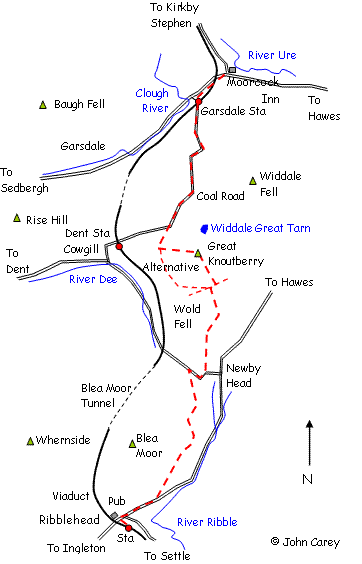
Great Knoutberry Hill from Ribblehead to Garsdale House
-
Ribblehead to Garsdale House via Great Knoutberry Hill
Ribblehead to Garsdale House via Great Knoutberry Hill [672m] - A long linear walk but not particularly challenging with no severe uphill stretches most of the route using the Dalesway and the new Pennine Bridleway. Ideal for low cloud with some good views the only down sides being a stretch of main road at Ribblehead and the Coal Road above Dentdale. By train to Ribblehead returning from Garsdale
- 11.5 miles
- 5 hours
Alight the train at Ribblehead Station and turn right at the main road in front of the Station Inn. Follow the main road towards Hawes for a mile or so turning left up the vehicle track just after Gearstones and signposted Dalesway, Pass behind the farmhouse at Winshaw and continue to High Gayle with the wall on the right. The path dips sharply at two locations to cross small streams. Note it is possible to strike out from the main road across Blea Moor at a bend beyond the small bridge to reach the path above Winshaw however the terrain can be confusing.
After High Gayle bear slightly left in a northerly direction to follow the very obvious and well used path to Dent Head. Turn right along the minor road for 1/4 mile and then left through a gate to follow the recently created Pennine Bridleway rising slightly uphill to Wold Fell. Passing through a gate the track is now in a walled enclosure for a short while. At the top of the walled section pass through the gate and bear left and proceed with the wall on the left around the side of Wold Fell eventually to intersect the bridleway at the head of Artengill.
There are two options at this point. To take in the easy ascent of Great Knoutberry Hill turn right for 200m to so and then left over a stile. Follow the path uphill with the wall/fence on the right. The summit trig point will soon come into view. Carry on now with the fence on the right to emerge at the bridleway at bottom at a gate. Turn right and continue to reach the Coal Road. Alternatively it is possible to descend from the summit crossing the fence/wall next to the trig point and following the other fence down to Widdale Great Tarn. From here it would be necessary to free-range across the open fell (and an odd fence) to reach the Coal Road down below - only recommended for the more hardy!
However the easier option to avoid Great Knoutberry altogether would be to cross the Arten Gill path [actually now part of the Pennine Bridleway] and continue straight on, the bridleway following the contour around the side of Dent Fell still with excellent views down into Dentdale. This eventually meets the Coal Road and continue as described below.
Continue straight along the Coal Road at the same elevation The Coal Road provides a link between Dentdale and Garsdale although at 1750ft elevation is often impassable to motor vehicles in Winter! Unfortunately the next 2 miles is by road although the views are impressive and there is very little traffic. The road drops steeply down to Garsdale Station. Pass under the rail bridge and turn right immediately beyond the railway houses to follow the new bridleway down to Garsdale House.
The return to the station is by the same route unless advantage is taken of the Little White Bus service. Remember to allow 30-35 minutes for the return walk to the station.
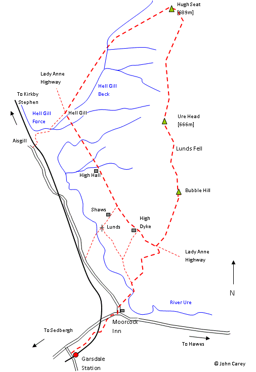
Lunds Fell [666m] and Hugh Seat [689m]
-
Lunds Fell and Hugh Seat
A strenous and rewarding upland walk taking in the summits of Lunds Fell [667m] and Hugh Seat 689m] starting at Garsdale Station or Garsdale House
- 10 miles
- approximately 5 hours
Starting from Garsdale Station follow the Pennine Bridleway down to Garsdale House. Take the Kirkby Stephen road to the left of the pub and very soon bear right along the Pennine Bridleway. This proceeds to the bridge serving Yore House and Ure head Force waterfalls. Crossing the bridge bear left for a short while and then turn right through the gate on the right just past Cobbles Plantation. The Bridleway proceeds uphill to the side of the plantation before turning left and then right to reach Lady Anne Highway. Passing through the gate turn left and after a small ravine leave the track and strike out diagonally [north east] to gain height. Maintain an upward course crossing a fairly easy stock fence eventually reaching the crest of Bubble Hill. A landrover track comes into view and this can be followed up to the summit of Lunds Fell [667m] where there is a diminutive cairn. Just to confuse things the top is referred to variously as Sails, Lunds Fell, Ure Head and Little Fell all of which are named on the map! There are good views in all directions with Shunner Fell to the east and Wild Boar to the west.
Leave the cairn at Lunds Fell in a northerly direction. The track disappears and a few boggy patches require negotiation. Follow a stock fence on the left as the ground gains height. This starts to bear left. Beware of a boggy hollow usually protected with a roll of fencing! The fence turns to the left and forms a V shape near the summit of Hugh Seat [689m]. The cairn is just below the summit and provides an excellent vantage point across the Mallerstang valley. On leaving Hugh Seat progress quickly downhill in a westerly direction towards a further cairn and eventually to an obvious confluence of Hell Gill Beck and another minor stream. These are the upper flows of the River Eden. Drop down into the ravine and up the other side where a path will be located following to the right of Hell Gill Beck.
The path progresses downhill and emerges at Lady Anne Highway. Turn left to cross Hell Gill Bridge a fearsome and narrow ravine. It is difficult to see the bottom. Progress along the Highway bearing left at fork. The track passes High Hall and High Dyke disused farmhouses. After dropping down to a small ravine where there has been some landslip the track emerges back at the sign post for the Pennine Bridleway. Turn right through the gate and retrace steps to Ure Head Force and Garsdale House.
An alternative route can be taken by leaving Lady Anne Highway by crossing a stile immediately before a gate and descending the path to the rear of Shaws to reach Lunds Church. From here there is a choice of a boggy route to Ure Head Force via Blades or cross the river Ure and follow the track / path up to the road and back to Garsdale House. These routes are described elsewhere.
Allow 30-35 minutes for the uphill walk back to Garsdale Station or alternatively catch the Little White Bus.


Proud to be featured in
'The Ultimate List of Vegan Accommodation in the UK'

Proud to be featured on the
'UK Vegan Hotels and B&Bs –
The Ultimate Guide'

Proud to be featured on the
'VEGAN FAMILY HOLIDAY AND CAFE MAP'